The Austral precinct development 2026 pipeline is defined by concrete administrative decisions. Liverpool City Council has finalised contribution plan boundary adjustments affecting the precinct’s southern extent. Furthermore, multiple state government planning instruments are reshaping lot delivery timelines and land use outcomes across the catchment.
Austral sits within Sydney’s South West Priority Growth Area. Boundary adjustments to the Contributions Plan have clarified the catchment separation. Specifically, the Austral core area and the Leppington North corridor now operate under distinct planning frameworks. Consequently, buyers and developers require precise identification of which planning instruments and contribution rates apply to each parcel.
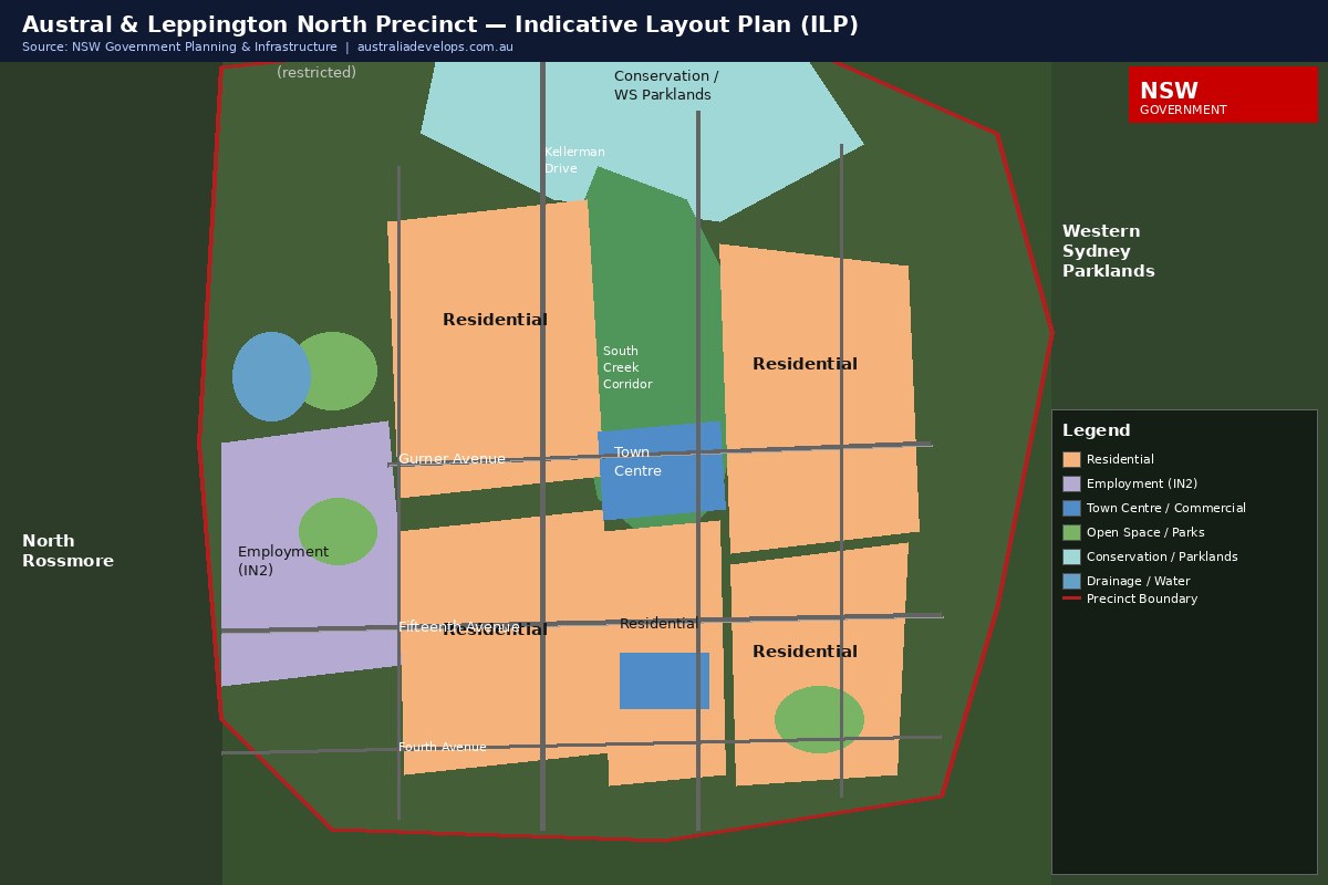
ZONE OVERVIEW — Administrative Boundaries & Contribution Plan Framework
Liverpool City Council’s revised Contributions Plan adjusted Austral’s southern boundary to the Ninth Avenue line. Parcels south of this boundary now fall under Leppington North’s separate planning framework, with distinct contribution levy structures.
| Zone | Southern Boundary | Planning Instrument | Key Focus |
|---|---|---|---|
| Austral Core | Ninth Avenue | Liverpool LEP + Contributions Plan | Residential land release |
| Leppington North | North of Leppington Major Centre | Separate structure plan | High-density mixed-use |
| Kemps Creek | North of restricted boundary | Development restriction applies | Excluded from residential supply |
The Leppington Major Centre and Leppington North corridor are progressing high-density mixed-use development under a separate masterplan. Notably, this distinction matters for land buyers comparing contribution levies and density assumptions across the two precincts. The NSW Planning portal maintains current land use maps for both zones.
In particular, different developer contribution rates apply depending on which zone a lot is situated in. Additionally, infrastructure levies vary significantly between Austral Core and Leppington North classifications. Consequently, independent planning advice remains essential before any land purchase commitment is made.
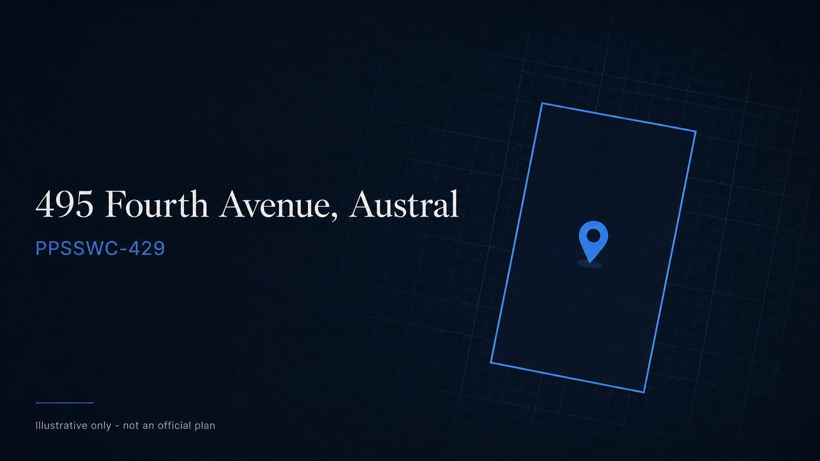
PROJECT 1 — 495 Fourth Avenue: Fast-Track Under RZ-3/2025
The 495 Fourth Avenue parcel is included in the Western Parkland City SEPP Amendment RZ-3/2025. This instrument, submitted to the Liverpool Planning Panel in November 2025, pursues increased residential density through the state’s fast-track assessment pathway.
The NSW Housing Delivery Authority accepted this scheme into its accelerated assessment process. In particular, this bypasses standard council DA timelines. Institutional investment infrastructure commitments have positioned this parcel as a benchmark case for precinct-wide density uplift.
However, the 495 Fourth Avenue site represents one specific planning case study within Austral. Furthermore, density assumptions from this parcel do not automatically transfer to adjacent lots. Therefore, independent planning advice is required before applying these parameters to a different site.
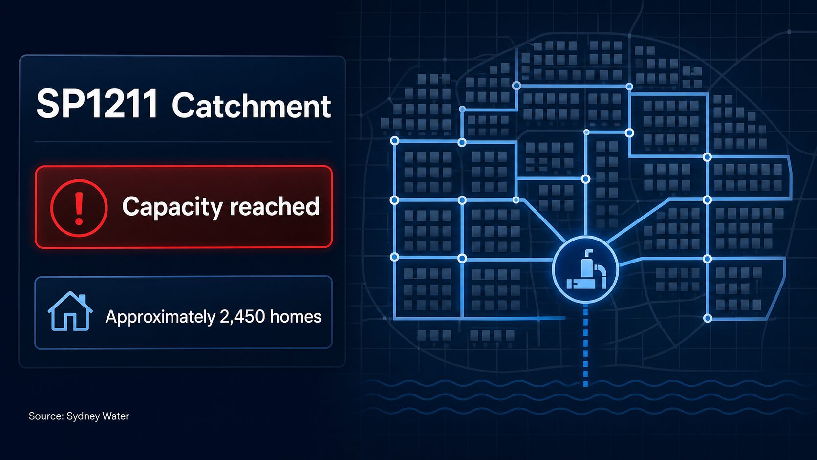
ZONE — SP1211 Catchment: Registration Capacity Reached
SP1211 reached full capacity with 2,455 lots registered as of mid-2026. This catchment is now closed to new buyers, redirecting demand to the Fifteenth Avenue corridor and adjacent release areas within the precinct.
This milestone represents the completion of one of Austral’s largest subdivision catchments. Commercial real estate yields in the Western Sydney corridor continue to attract institutional capital tracking residential supply pipelines. However, demand concentration following SP1211’s closure has not yet been fully absorbed by available alternatives.
| Metric | Data |
|---|---|
| Total lots registered | 2,455 |
| Catchment status | Capacity reached (mid-2026) |
| Austral-wide quarterly lot registration rate | ~175 lots per quarter |
| Next demand absorption zone | Fifteenth Avenue corridor |
Notably, the corridor extends south through the South West Growth Area — including Leppington, which is tracking its own major development pipeline as demand continues to accelerate across the region.
PROJECT 2 — Austral Plaza: New Retail Precinct (Q3 2026)
Woolworths has confirmed as anchor tenant for Austral Plaza. The commercial precinct is scheduled for completion and opening in Q3 2026, establishing walkable retail access for residents across the precinct for the first time.
The Austral Plaza development signals that the precinct has reached sufficient residential density to support neighbourhood retail viability. Furthermore, the arrival of a major supermarket anchor typically underpins surrounding land values at a neighbourhood centre scale. Additionally, daily service amenity reduces the barrier to first-home buyer settlement in newly released stages.
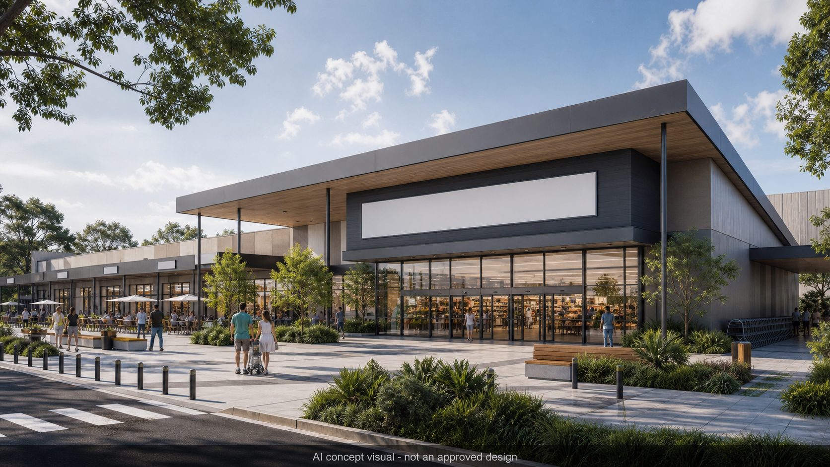
Together, neighbourhood retail, accessible amenity, and local employment capacity create the structural conditions for sustained residential demand. Indeed, the Austral precinct development 2026 trajectory increasingly reflects an established community in active formation. This contrasts with earlier phases defined primarily by speculative land release activity.
PROJECT 3 — Landcom Gurner Avenue: 58-Hectare Shared Zone Masterplan
Landcom’s Gurner Avenue masterplan, approved in 2023, covers 58 hectares. It introduces Sydney’s first residential precinct with a 10km/h shared zone road design. The project was delivered by Landcom in partnership with e8urban and Scape Design, with concept work commencing in 2021.
The shared zone road design is a deliberate urban heat island mitigation strategy. Specifically, vehicle speeds are limited to 10km/h across the precinct’s internal road network. Consequently, pedestrian activation takes precedence over vehicle throughput throughout the development.
Integrated green corridors address the structural greenspace deficits common in Western Sydney greenfield releases. Furthermore, the Gurner Avenue design represents a significant departure from conventional subdivision layout practice. Additionally, the Western Sydney Airport precinct planners are monitoring this shared zone model as adjacent urban development zones take shape.
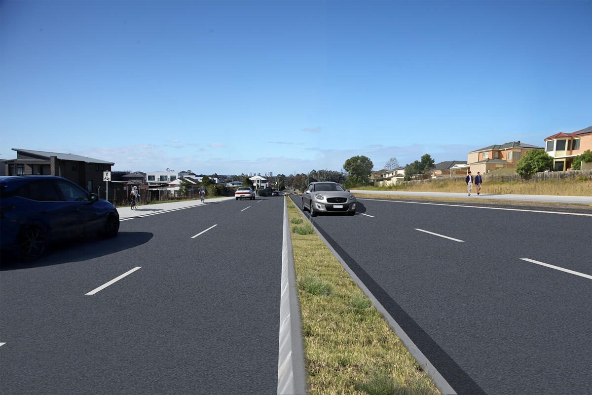
INFRASTRUCTURE — Fifteenth Avenue FAST Transit Corridor
Liverpool City Council has formally objected to the state government’s Fifteenth Avenue Smart Transit (FAST) design. Three structural deficiencies have been identified: reduced lane capacity, an absent airport rapid link, and insufficient pedestrian activation zones.
The Fifteenth Avenue corridor is progressing approximately 160 lots across a 10-hectare site. However, transit infrastructure underpinning this corridor remains the subject of a formal government dispute. In particular, Liverpool City Council has submitted formal representations identifying three structural deficiencies in the current FAST route proposal.
| Issue Raised by Liverpool City Council | Council Position |
|---|---|
| Road lane capacity | Proposed design reduces effective vehicle throughput |
| Airport rapid transit link | No direct fast connection to WSI Airport in current design |
| Pedestrian activation zones | Insufficient pedestrian-priority areas along the corridor |
Western Sydney International Airport is scheduled to open on 25 October 2026. Therefore, the absent rapid transit link in the current FAST design is a material concern. Additionally, it limits the connectivity dividend for investors tracking airport-driven demand in the Austral catchment. Liverpool City Council’s advocacy to the state government continues as of mid-2026.
Aerotropolis precinct land banking has entered its execution phase across Western Sydney. Consequently, the resolution of the FAST corridor dispute will materially affect the investment case for Fifteenth Avenue lots. Furthermore, road construction is already connecting previously isolated parcels to the wider precinct network. However, the transit question remains unresolved pending the state government’s response.
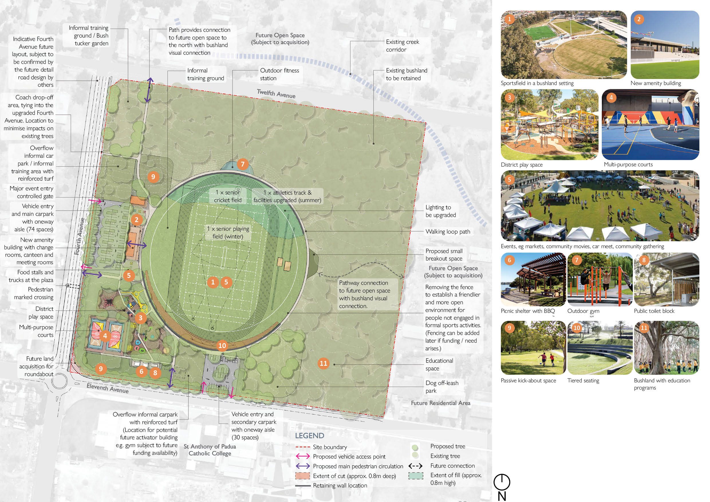
INFRASTRUCTURE — Craik Park & Open Space Masterplan
Craik Park is a committed open space anchor within the Austral masterplan. It provides stormwater management capacity, pedestrian connectivity, and community amenity for surrounding residential clusters across the precinct.
Parks of this scale serve multiple structural functions in precinct planning. Furthermore, integrated open space provides stormwater management capacity and reduces heat load on surrounding streets. Moreover, pedestrian connectivity networks anchored by major parklands typically support long-term residential desirability across comparable Western Sydney releases.
Foreign Direct Investment (FDI) Australia benchmarks increasingly highlight Western Sydney as a priority residential corridor. Consequently, the open space and infrastructure commitments within the Austral masterplan are being tracked by institutional capital groups. Additionally, these commitments signal planning depth beyond minimum standard requirements for comparable greenfield releases.
ZONE — IN2 Light Industrial: Zoning Amendment RZ-7/2023
RZ-7/2023 prohibits hotels and motels within Austral’s IN2 light industrial zone. Permitted commercial uses are now limited to takeaway food, cafes, and ancillary retail serving the local workforce, protecting the residential environment from amenity conflicts.
This amendment refines the boundary between industrial and residential land use within the precinct. Moreover, it provides certainty to residential purchasers that accommodation establishments will not operate within the IN2 zone. Additionally, the amendment reduces potential amenity conflicts for surrounding residential areas over the longer term.
The zoning refinement reflects a broader pattern of regulatory maturation within the precinct. Consequently, the IN2 zone is increasingly characterised as employment-generating rather than hospitality-oriented. However, small-scale food and beverage outlets serving the local industrial workforce remain permitted under the amended controls.
Austral Precinct 2026 — Key Data at a Glance
| Development Indicator | 2026 Data | Key Implication |
|---|---|---|
| Median house price | ~$1,160,000 | +26% over 12 months |
| Quarterly lot registration rate | ~175 lots/quarter | Consistent supply absorption across the precinct |
| SP1211 capacity | 2,455 lots registered | Catchment closed; demand redirecting to Fifteenth Avenue |
| Austral Plaza completion | Q3 2026 | Woolworths anchor tenant confirmed |
| WSI Airport opening | 25 October 2026 | Transit connectivity implications for adjacent precincts |
| 495 Fourth Avenue LPP submission | November 2025 | RZ-3/2025 density uplift pathway active |
| Gurner Avenue masterplan approval | 2023 | 58ha, 10km/h shared zone design by Landcom + e8urban |
| IN2 zone amendment | RZ-7/2023 | Accommodation prohibition confirmed; limited commercial permitted |
SUMMARY — Austral Precinct Investment Case
Overall, the Austral precinct development 2026 outlook reflects a precinct transitioning from raw land release to structured community delivery. Fast-track planning instruments are activating key sites. Additionally, retail and open space infrastructure milestones are arriving within the same delivery window as the first residential completions.
Consequently, boundary clarity, commercial activation, and contested transit infrastructure create a complex but data-rich assessment environment. Furthermore, the IN2 zoning amendment and the Gurner Avenue shared zone masterplan distinguish Austral from conventional Western Sydney greenfield releases. Together, these administrative decisions reflect deliberate planning choices rather than incremental default outcomes.
Indeed, informed decision-making in this precinct requires precise analysis of each parcel’s zone and applicable planning instrument. Therefore, independent planning and financial due diligence remains essential for all buyers and developers entering the Austral market in 2026.