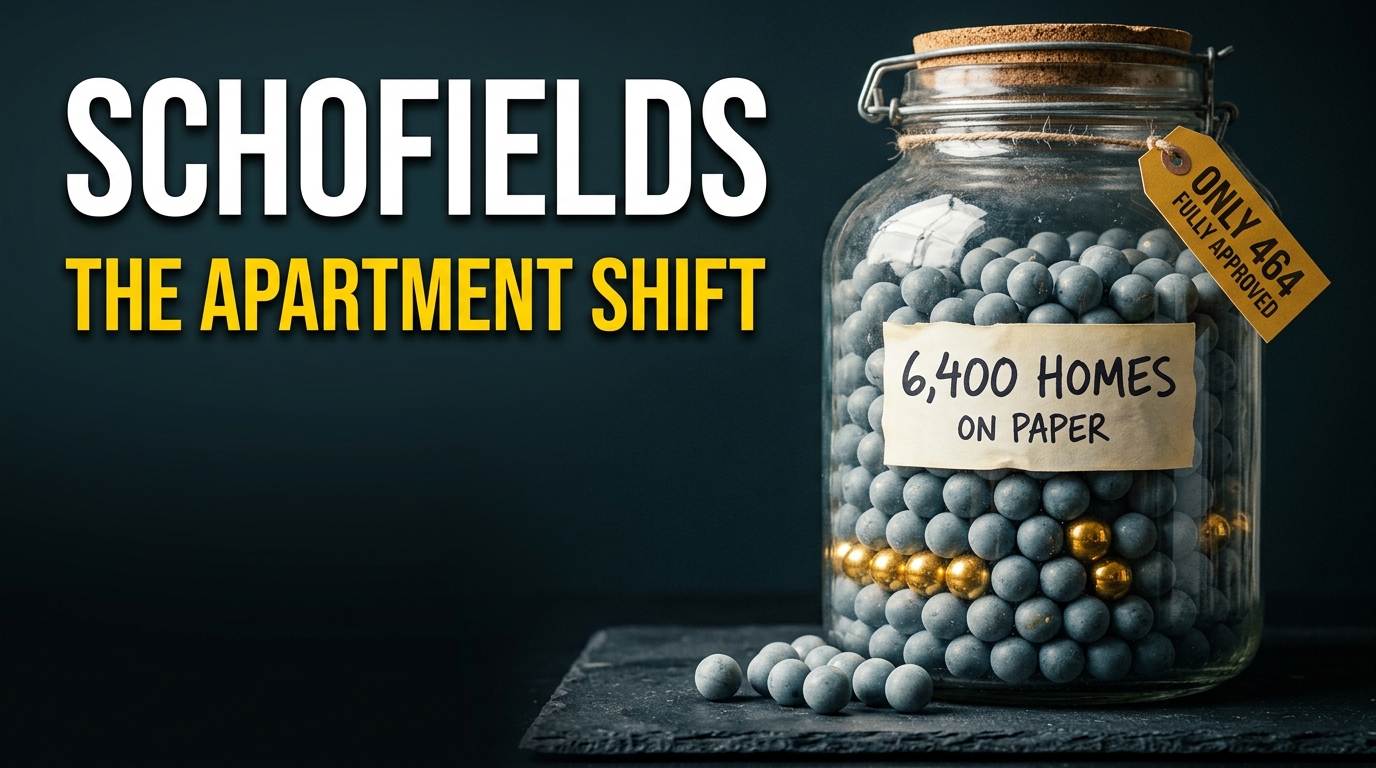
Schofields development is moving from house-and-land to apartments, and the change is happening fast. So I went through the NSW Planning Portal, the Sydney Central City Planning Panel records and the state’s rezoning pages, and I count 8 live projects in postcode 2762. Together they now cover about 6,400 homes on paper. The newest of them is a plan for 4 towers of 14 to 15 storeys on Railway Terrace, which went on exhibition on 25 September 2026. Then there’s the West Schofields rezoning for about 2,900 homes, which the state expects to finalise this year. Here is every project, its address, its status and what comes next.
This article was produced and reviewed by the Australia Develops editorial team. See our Editorial Policy for sourcing standards and methodology.
Where is Schofields?
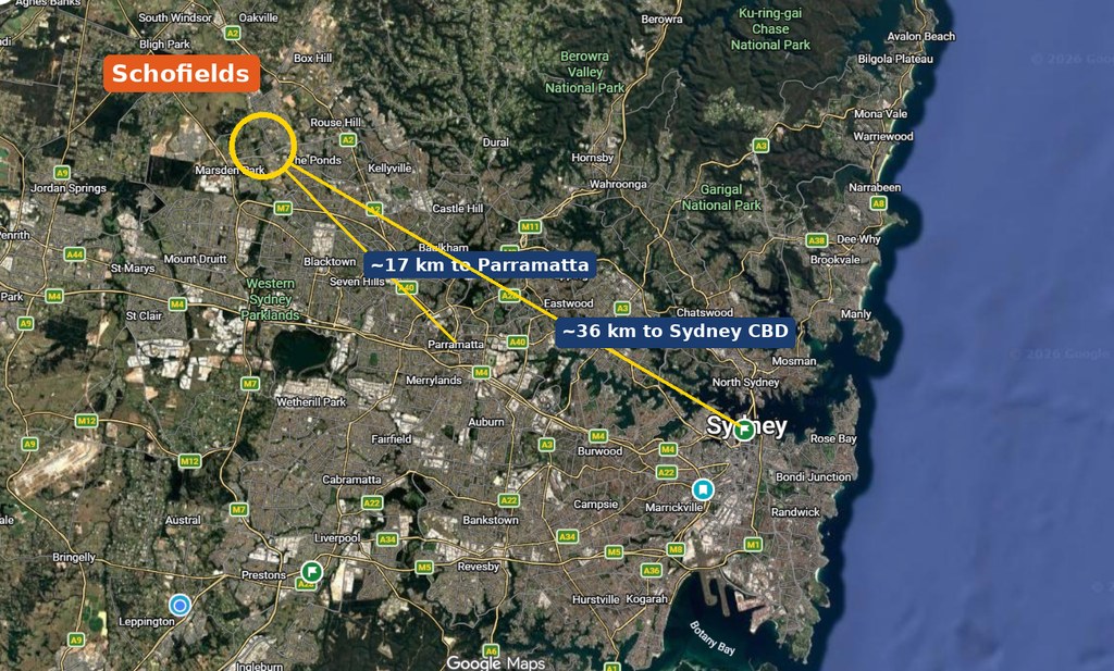
Schofields is in Blacktown City Council at postcode 2762, about 36 km north-west of the Sydney CBD and 17 km north-west of Parramatta in a straight line, with Blacktown about 8 km to the south-south-east. Its station also sits on the Richmond branch of the T1 Western Line, between Quakers Hill and Riverstone.
Schofields Development — The Pipeline
First, some background, because Schofields is really 2 growth precincts split by the railway. First, east of the line is the Alex Avenue precinct, rezoned in May 2010 for up to 6,300 homes on 420 hectares between Burdekin Road and Schofields Road. Then west of the line is the Schofields precinct, rezoned in May 2012 for up to 2,950 homes on 465 hectares, running out to Eastern Creek. Most of that land now has houses on it. So what’s left is denser: apartment sites near the station, 2 state-led rezonings and a few sites that need a zoning change first.
The 8 Schofields development projects at a glance
| # | Project / address | Developer | Scale | Status |
|---|---|---|---|---|
| 1 | Mixed use towers, 209 Railway Terrace | Trustee for Statewide Planning Trust | 494 apartments, 4 towers of 14 to 15 storeys, supermarket, childcare; $267.8m | Exhibited 25 Sep to 9 Oct 2026, then submissions response (SSD-93526458) |
| 2 | Railway Terrace rezoning, 249 to 271 Railway Terrace | Provincial Investments | Up to 1,700 homes, 4 storeys to 8 | Finalisation stage (report dated Nov 2024) |
| 3 | West Schofields state-led rezoning | NSW Government (DPHI) | About 2,900 homes, 600+ jobs, almost 170 ha open space | Post-exhibition; finalisation still expected 2026 |
| 4 | Schofields Station precinct rezoning | NSW Government (DPHI) | Homes still not stated | Pre-exhibition; then exhibition due 2027 |
| 5 | Apartments, 60 Pelican Road and Lots 12A and 13A Pelican Road | Not named on panel records | 401 approved, while 328 are proposed | Approved 14 Feb 2025; second DA now back with council |
| 6 | Residential flat buildings, Lot 4 Farmland Drive | Catalina Project No 2 | 550 dwellings, 8 buildings up to 18 m; $200m | Preparing EIS, so not yet exhibited (SSD-114901240) |
| 7 | Affordable apartments, 108 Burdekin Road | Link Wentworth with Landcom | 63 affordable units over 6 storeys, all rentals | Approved 24 May 2025, since modified (SSD-71488960) |
| 8 | Private school, 63 Townson Road | Al Faisal College (owner) | 870 students; $17.7m | Refused 9 Dec 2025 but school backed in principle (PPSSCC-596) |
Read down the table and one thing stands out: the big home counts sit almost entirely in rezonings and proposals, not in approvals anyone can build on yet. The headline numbers are worth separating out before going project by project.
Where the Projects Sit
Those totals make more sense with the geography in front of you. Schofields splits into two halves that behave quite differently: the station precinct along Railway Terrace, and the estates spreading north and west of it. The overview below is the quickest way to place each project.
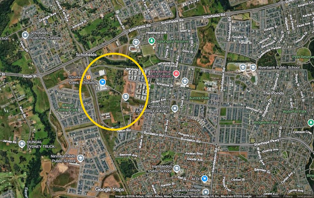
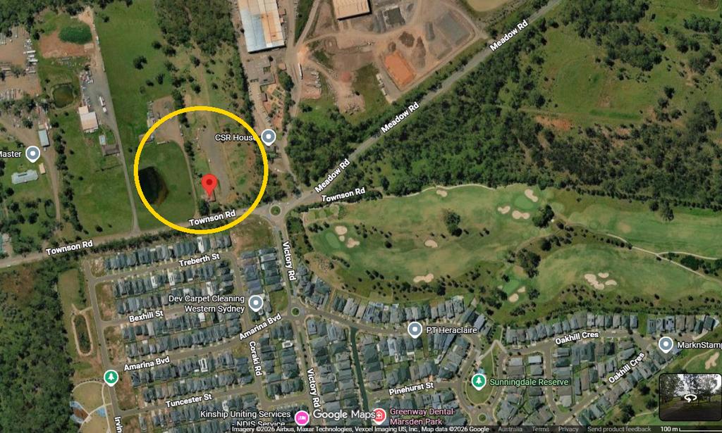
Most Schofields development activity hugs the railway. For example, the station’s main car park faces Railway Terrace on the eastern side, and both of the big apartment plans front that street. Next, Pelican Road, Farmland Drive and Burdekin Road sit further east in the Alex Avenue estates, around Galungara Public School. By contrast, West Schofields is the outlier. It covers the flood-affected land on the far western side, out past Eastern Creek towards Townson Road, and that’s also where the refused school site sits.
PROJECT 1 — 494 apartments in the tallest Schofields development plan at 209 Railway Terrace
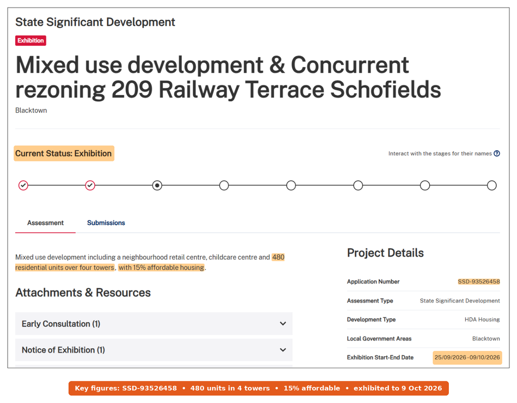
Status: Exhibition, 25 September to 9 October 2026 (State Significant Development, SSD-93526458)
Location: 209 Railway Terrace, Schofields NSW 2762, near Schofields station. The applicant is currently the Trustee for Statewide Planning Trust, with Tony Owens Partners as architect, according to Urban Digest. It’s now the largest single building proposal in the suburb.
What the station towers would include
Initially, the Major Projects page described a neighbourhood retail centre, a childcare centre and 480 units over 4 towers, with 15% affordable housing. However, the exhibited scheme as reported counts 494 apartments: 82 one-bedroom, 360 two-bedroom and 52 three-bedroom. Of those, 95 would be affordable homes, while the towers would rise 14 to 15 storeys, to about 54 m. In the podium, there’s also a 2,724 m² supermarket, a 493 m² gym, 2 shops and a 111-place childcare centre. So the capital investment value comes to $267.8 million.
Why it needs a rezoning as well
Currently, the controls cap height at 18.5 m. So the applicant is seeking a concurrent rezoning to 54 m, with floor space lifting from 3.5:1 to 4.6:1. The portal lists it as “HDA Housing”, which means it came through the state’s Housing Delivery Authority stream. That’s also why the state assesses it, not Blacktown Council.
The site also already has a consent. Back on 19 December 2019, the planning panel approved a shop top housing scheme here with 242 apartments and 4,092 m² of ground-floor retail, worth $66.7 million (JRPP-16-03327). The new plan would replace that lower scheme. After that, next comes the response to submissions, then the department’s assessment. Still, no decision date has been published.
PROJECT 2 — Up to 1,700 homes in the Railway Terrace rezoning
Status: Finalisation stage (state-assessed planning proposal; finalised documents dated November 2024)
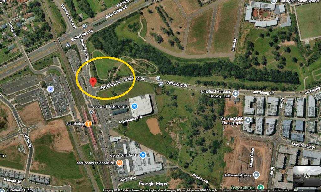
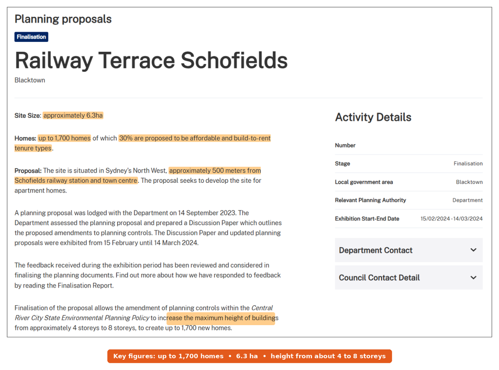
Location: 249 Railway Terrace, Schofields NSW 2762 and the neighbouring lots at 259 and 271, a U-shaped site of about 6.3 hectares. The planning proposal page also puts it about 500 metres from the station and town centre. The developer is Provincial Investments, according to The Urban Developer, and the site wraps around a council-owned dam.
What the rezoning allows
In short, the proposal lifts the height limit from about 4 storeys to 8 storeys. In return, it allows up to 1,700 homes, and 30% would be affordable or build-to-rent. When the state put it on show in February 2024, it described a $500 million project for 1,751 homes, with heights rising from 16 m to 32 m. But that release used a 33% figure for affordable and build-to-rent housing, held for at least 15 years. The developer had first lodged the proposal on 14 September 2023. Then the department exhibited it from 15 February to 14 March 2024.
The history on this site
This land has a long record. Back in 2017, an applicant sought consent for 20 apartment blocks across 249, 259 and 271 Railway Terrace, worth $268.2 million. But the planning panel refused that DA on 26 October 2020 (SPP-17-00026). I couldn’t open the panel’s reasons, so I won’t guess at them. Now the rezoning route has replaced it.
The portal now lists the proposal at “Finalisation”, with a finalisation report dated November 2024. Still, it doesn’t confirm the date the amended controls took effect. After that, a fresh development application would have to follow before any building work, and I found none on the public record.
PROJECT 3 — About 2,900 homes in the West Schofields development rezoning
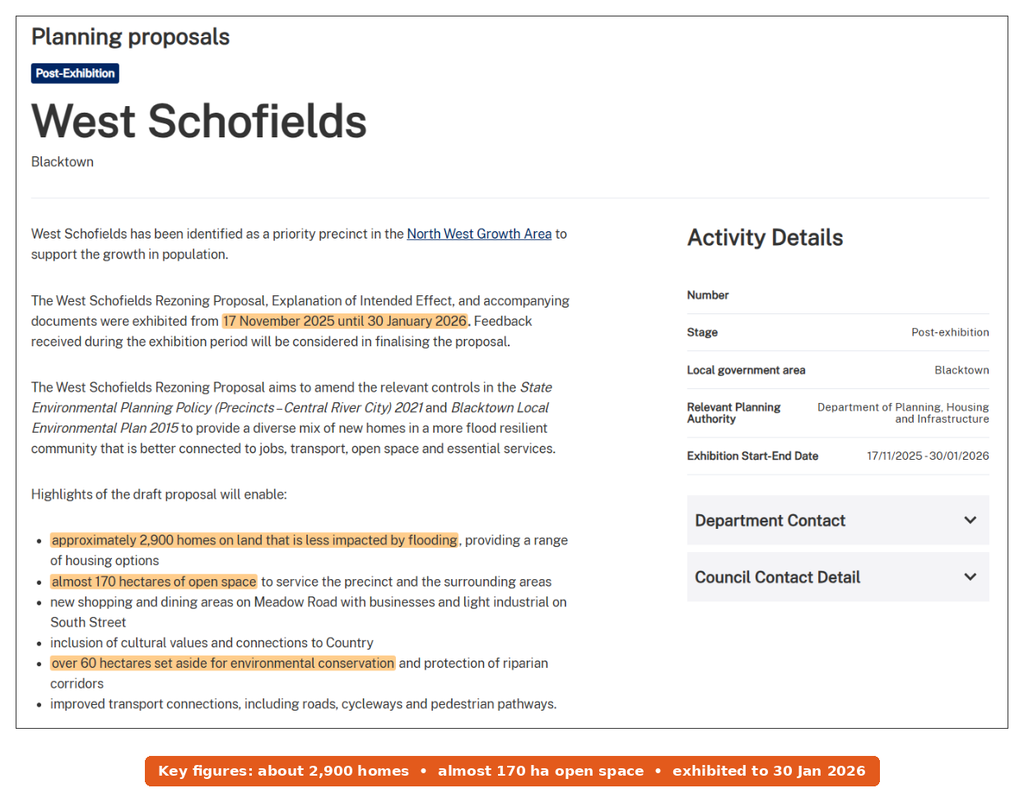
Status: Post-exhibition (exhibited 17 November 2025 to 30 January 2026; finalisation expected in 2026)
Location: the West Schofields precinct, on the western edge of the suburb in the North West Growth Area. The Department of Planning, Housing and Infrastructure leads it, so this is a state-led rezoning. As a result, it would change both the Central River City SEPP and the Blacktown LEP 2015.
Why the 2018 plan stalled
The state first exhibited a draft plan in 2018, for up to 4,500 homes. Then major floods hit the Hawkesbury-Nepean, and the NSW Flood Inquiry followed in 2022. As a result, the department decided in 2023 that the 2018 plan should not proceed. Its Flood Advisory Panel found that flood risk in West Schofields “may be greater than previously known”, according to the precinct page. After that, work on a new plan started in September 2024.
What the revised plan offers
Now the new version is smaller, at about 2,900 homes on land less affected by flooding. The planning proposal page also lists almost 170 hectares of open space and over 60 hectares for conservation and creek corridors. On top of that, the precinct page describes new shopping and dining on Meadow Road and business and light industrial uses on South Street.
In addition, the ministerial release adds over 600 new jobs and work on Eastern and Bells Creeks. It also promises stricter measures for safe evacuation. For instance, Blacktown Mayor Brad Bunting said the plan puts development on “safer, less flood-prone land”. Now the department is working through submissions before a finalisation report. Before you buy anywhere on the western side, check the flood maps first. In fact, my guide to flood and bushfire maps shows where to find them.

PROJECT 4 — A new rezoning around Schofields station
Status: Pre-exhibition (state-led rezoning; exhibition scheduled for 2027)
Location: land around Schofields station. The Schofields Station precinct page says the proposal “seeks to rezone land around Schofields Station to support a coordinated approach to development.” The department adds that a state-led process will deliver open space, housing and jobs in an integrated way.
That’s the whole public record so far. There’s no home count, no height and no boundary map yet. Instead, further investigations will set the scale of development and the infrastructure it needs. It also follows years of drift on the Schofields Town Centre plan, which Blacktown Council took over in 2019. The department says updated controls depend on fixing a corridor for a future Metro extension first.
So this one matters for anyone near the station, because it could shape the town centre for decades. Still, you can’t price it in yet. For a sense of where similar station-led rezonings have landed elsewhere, see my piece on the TOD rezoning program.
PROJECT 5 — 729 apartments across 2 Schofields development sites on Pelican Road
Status: 60 Pelican Road approved (Sydney Central City Planning Panel, 14 February 2025); Lots 12A and 13A returned to Blacktown City Council
60 Pelican Road: 401 units approved
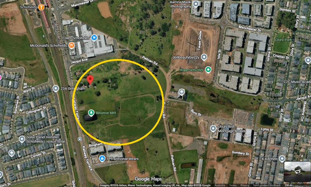
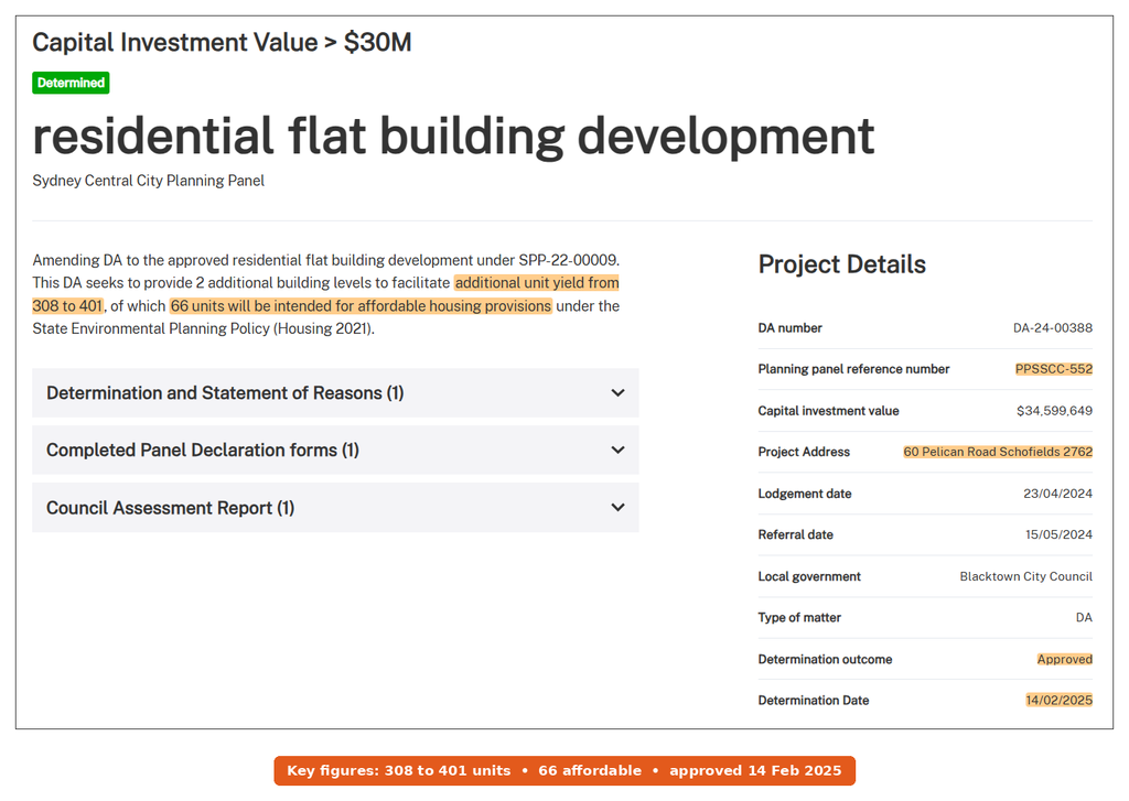
Location: 60 Pelican Road, Schofields NSW 2762, in the Alex Avenue precinct, near Galungara Public School. First, the panel approved the original scheme on 15 November 2023 (SPP-22-00009, PPSSCC-408). Initially, it allowed 2 super lots, a new road and 7 buildings of 5 storeys, worth $79.9 million. Then an amending DA added 2 more levels and took the yield from 308 to 401 units. Of those, 66 are now affordable housing under the Housing SEPP.
The panel approved that change on 14 February 2025 (DA-24-00388, PPSSCC-552), with the added work valued at $34.6 million. However, the panel pages don’t name the applicant, and I found no published start date.
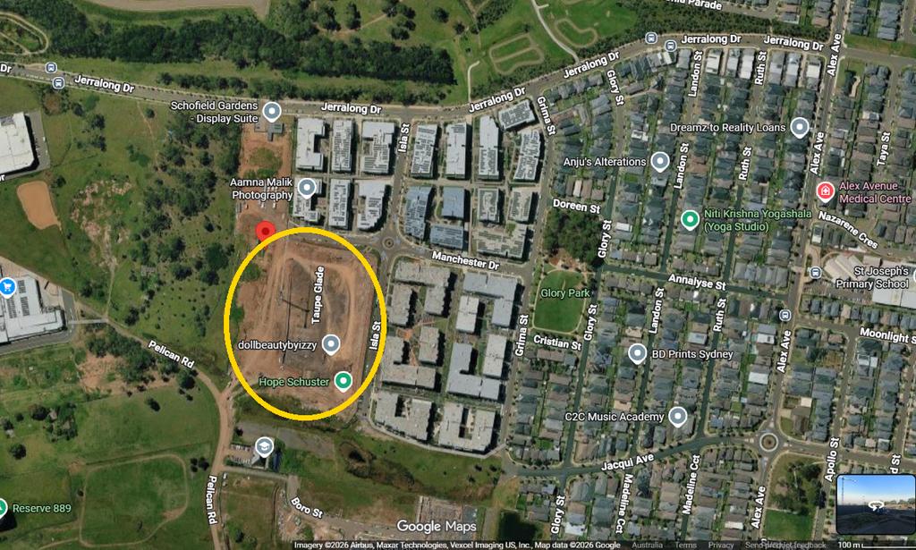
The panel record tells you what was approved. The satellite view shows what the site looks like while that approval waits to be built.
Lots 12A and 13A: 328 apartments proposed
Further along Pelican Road, an older consent (SPP-16-04465) is also getting a rework. This amending DA, DA-25-00627, now seeks a building with 328 apartments, including 51 affordable homes, on Lots 12A and 13A. The applicant first lodged it on 5 May 2025, with a value of $23.8 million. However, the panel record (PPSSCC-780) now shows “Returned to council”, dated 23 September 2025. In other words, the decision sits with Blacktown City Council. I couldn’t find a published determination yet.
PROJECT 6 — 550 dwellings on Lot 4 Farmland Drive
Status: Prepare EIS (State Significant Development, SSD-114901240; SEARs issued 10 April 2026)
Location: Lot 4 Farmland Drive, Schofields, the same street as Galungara Public School. The Major Projects page describes “Construction of 550 dwellings in eight residential flat buildings up to 18m on the site.” The developer is Catalina Project No 2 Pty Ltd, with Mecone as planner, as reported by Urban Digest.
Still, the detail locals should notice is the zoning. Currently, the land carries an SP2 Infrastructure (Educational Establishment) zone, which is land set aside for a school. So the developer wants a concurrent rezoning to R3 Medium Density Residential. Each of the 8 buildings would be 5 storeys, while the site covers 2.63 hectares. The estimated cost is $200 million, yet reported figures show no affordable housing.
The SEARs flag issues such as biodiversity, traffic and contamination. Like Project 1, it’s listed as “HDA Housing”. Next, the developer has to lodge an EIS, and only then will the public get a say. Since it only has a lot number, I haven’t mapped it as an exact address.
PROJECT 7 — 63 affordable homes at 108 Burdekin Road
Status: Approved (24 May 2025; SSD-71488960; Modification 1 determined)
Location: 108 Burdekin Road, Schofields NSW 2762, on the southern edge of the Alex Avenue precinct. The approval record covers a 6-storey building with 63 affordable units, owned and managed by a registered community housing provider. Link Wentworth will then build and run it, in partnership with Landcom. It’s 100% affordable, with a mix of 1, 2 and 3-bedroom homes, and it won funding in the second round of the Housing Australia Future Fund.
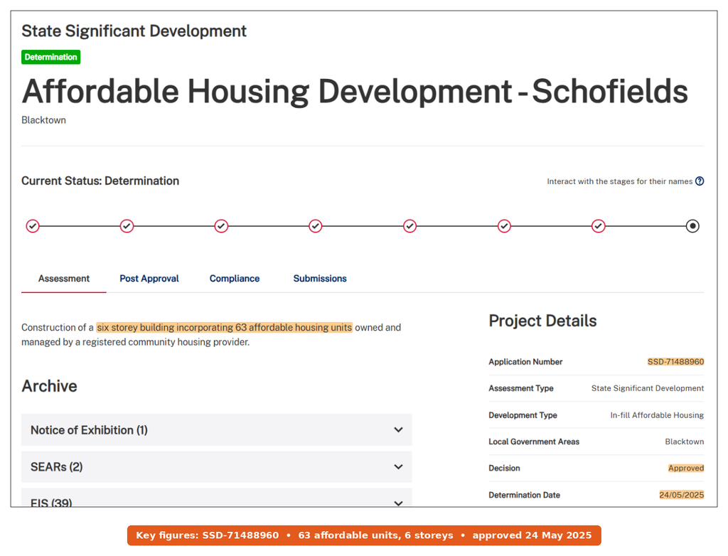
Landcom’s wider Burdekin Road estate
The building is part of a 4-hectare Landcom estate about 1.4 km from the station. So far, Landcom plans at least 140 homes there, with at least 30% affordable for key workers. Initially, Blacktown Council approved the subdivision in October 2020. After that, civil works ran from 2022 to 2024, and lot sales began in 2025.
As of May 2026, Landcom said construction of the 63 apartments was expected to start later this year, and a first batch of modular terraces was selling. Link Wentworth had also earlier targeted a start by June 2026 and keys by 2028. But I haven’t seen a public update confirming that works have started.
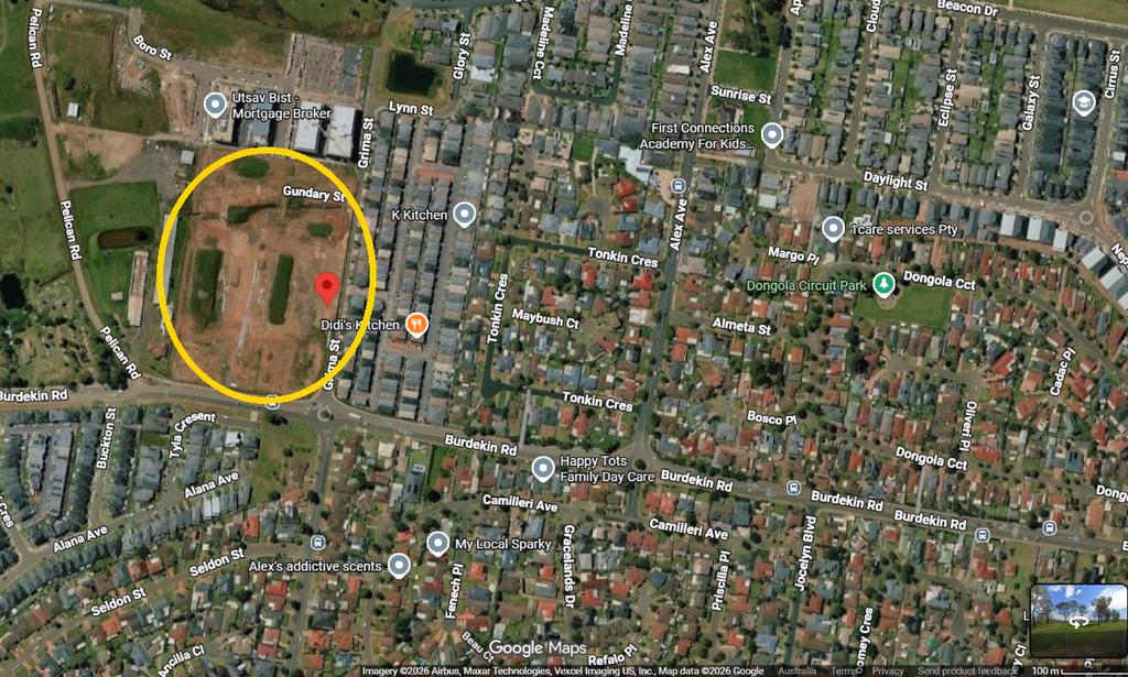
PROJECT 8 — An 870-student school at 63 Townson Road (refused)
Status: Refused (Sydney Central City Planning Panel, 9 December 2025; unanimous)
Location: 63 Townson Road, Schofields NSW 2762, inside the West Schofields area. The owner is Al Faisal College, while ADS Associates lodged the DA on 13 August 2024 (DA-24-00789, PPSSCC-596). The plan was for a school of 870 students, valued at $17.7 million.
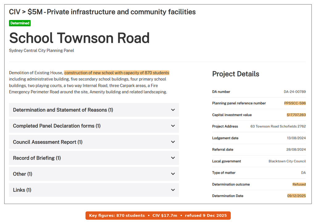
Why the panel said no
Blacktown Council recommended refusal, and the panel agreed. It adopted the council’s reasons, but it dropped a point about integrated development. Then it added a new reason. The school clashed with the draft West Schofields controls on open space, roads and access, and “may compromise the strategic development of the locality”. Also, the bushfire asset protection zone would have sat on a neighbour’s land, and that owner objected. In addition, the panel received 50 objections, which raised issues such as traffic on Richmond and Townson Roads, flooding and the nearby brickworks.
What happens next on Townson Road
Even so, the panel said it supports a school on this site in principle, given local growth. In its words, the plan is “not supported in its current form”, and the layout changes needed are likely big enough to warrant a new application. So the likely next step is a redesign once the West Schofields controls are final. So far, I found no appeal or new DA on the public record.
The Infrastructure Behind the Growth
Schools that are open or on the way
Schools are now the best news here. In March 2026, the Schofields Public School upgrade finished, with a new 3-storey building of 24 classrooms built by Lipman. As a result, hundreds of students moved out of older demountables. Then there’s Galungara Public School on Farmland Drive, which opened at the start of Term 1 2021 for up to 500 students, and it’s designed to grow to 1,000.
Its stage 2 has added 20 learning spaces and a covered outdoor area, in use since Term 1 2023. The games court and landscaping are still going, with forecast completion in early 2027. A bus bay on Pelican Road and a raised crossing on Farmland Drive are still at the design stage.
High school is the gap that’s closing next. The state started building a new high school at 201 Guntawong Road in Tallawong in December 2025, for 1,000 students, and the minister described it as serving families in Schofields and Tallawong. It’s currently on track to open on Day 1 Term 1 2027. My Tallawong development guide also covers that site in more detail.
Roads, rail and the station
Schofields Road was rebuilt in stages, and the last section, from Veron Road across Eastern Creek to Richmond Road, opened in June 2018 as a 2.5 km, 4-lane road with flood-free creek crossings. Later, at the station, Transport for NSW added a 700-space commuter car park north-west of the platforms, finished in August 2022. For rail, Transport for NSW has protected a corridor from Tallawong through Marsden Park to St Marys, with an interchange opportunity at Schofields. But that’s corridor protection, not a funded line.
Health, parks and flood work
For health, the November 2025 release points to a $910 million state and federal investment in the new Rouse Hill Hospital. It also mentions $180 million to speed up road upgrades in the north-west. Next, parks will mostly come through West Schofields, with almost 170 hectares of open space and creek work on Eastern and Bells Creeks. However, those depend on the rezoning going ahead.
What’s Next to Watch in Schofields Development
Here are the Schofields development milestones I’ll be tracking over the next 12 months.
- West Schofields finalisation. The department still expects to finalise the rezoning in 2026. Once it does, landowners on the western side can start lodging DAs.
- 209 Railway Terrace response. Exhibition closed on 9 October 2026, so the ball is now with the applicant. Next, the applicant answers submissions, and then the state assesses the towers.
- Station precinct exhibition. Watch for the first home numbers and heights when the plan goes on show in 2027.
- Farmland Drive EIS. The next step is lodging the EIS for 550 dwellings, which opens a public exhibition.
- Burdekin Road build. Look for site works to start on the 63 affordable homes, with keys targeted for 2028.
- New high school. The Guntawong Road school is now due to open for Day 1 Term 1 2027.
- Townson Road school. A redesigned DA is the likely path, since the panel backed a school there in principle. No date has been set yet, so watch the portal.
Project Status and Delivery Timing
| Project | Homes | Stage | Decision maker | Expected timing |
|---|---|---|---|---|
| 209 Railway Terrace towers | 494 | Exhibited Sep to Oct 2026 | NSW DPHI (SSD) | Decision not dated yet |
| Railway Terrace rezoning | Up to 1,700 | Finalisation | NSW DPHI | DA not yet lodged |
| West Schofields rezoning | ~2,900 | Post-exhibition | NSW DPHI | Finalisation still due 2026 |
| Schofields Station precinct | TBC | Pre-exhibition | NSW DPHI | Then exhibition in 2027 |
| 60 Pelican Road | 401 | Approved | Planning panel | Start not published so far |
| Lots 12A and 13A Pelican Road | 328 | Under assessment | Blacktown Council | Not dated yet |
| Lot 4 Farmland Drive | 550 | Prepare EIS | NSW DPHI (SSD) | Exhibition after EIS |
| 108 Burdekin Road | 63 | Approved | NSW DPHI (SSD) | Start due 2026, then keys 2028 |
| 63 Townson Road school | 0 | Refused | Planning panel | New DA likely, but not lodged |
My take
Schofields development is shifting towards apartments, and that shift centres on the station. If the towers at 209 Railway Terrace win approval, they’d also be by far the tallest buildings in the suburb. They’d also bring a large supermarket to the Railway Terrace side. Yet most of the home count still sits in rezonings, not consents. In fact, only about 464 of the roughly 6,400 homes I’ve counted have a full approval today. So I’d treat the big numbers as a direction of travel, not a delivery schedule.
The suburb’s strengths are real, though. For example, it has a station, upgraded schools, a high school opening nearby in 2027 and a protected rail corridor to the west. Next door, Riverstone is going through the same change, and Box Hill shows how fast the north-west fills once land is zoned. Flooding is the main caution, especially on the western side, and the state has already cut West Schofields once because of it. If you’re buying in, I’d favour the east side near the station and check every flood map first.
Questions locals are asking
Will Schofields get a bigger supermarket?
Possibly. The 209 Railway Terrace plan includes a 2,724 m² supermarket near the station, according to the exhibited scheme. But it’s only a proposal so far, and the state hasn’t decided it. The 2019 consent on the same site also allowed ground-floor retail, yet it never went ahead.
Is West Schofields safe from flooding now?
The revised plan puts homes on land “less impacted by flooding” and adds stricter evacuation measures, according to the department. That’s also why it dropped from 4,500 to about 2,900 homes. Still, lower risk isn’t no risk, so check the flood category for any lot before you buy.
What happened to the Al Faisal College school plan?
The planning panel refused it unanimously on 9 December 2025, after Blacktown Council also recommended refusal. The main problems were the asset protection zone on a neighbour’s land and the clash with the West Schofields plan. Even so, the panel backed a school on the site in principle.
Can first home buyers get into the new affordable homes?
No, because the 63 Burdekin Road units are affordable rentals run by Link Wentworth, so you can’t buy them. Instead, buyers should look at Landcom’s terraces or the open market. Then check whether the 5% deposit scheme price caps fit.
This article is general information based on NSW Planning Portal records, Sydney Central City Planning Panel decisions, Department of Planning, Housing and Infrastructure pages, School Infrastructure NSW, Transport for NSW and Landcom material available at publication. It isn’t financial advice. Approvals, timelines and home numbers can change, so check current details with Blacktown City Council and the NSW Planning Portal before you buy.