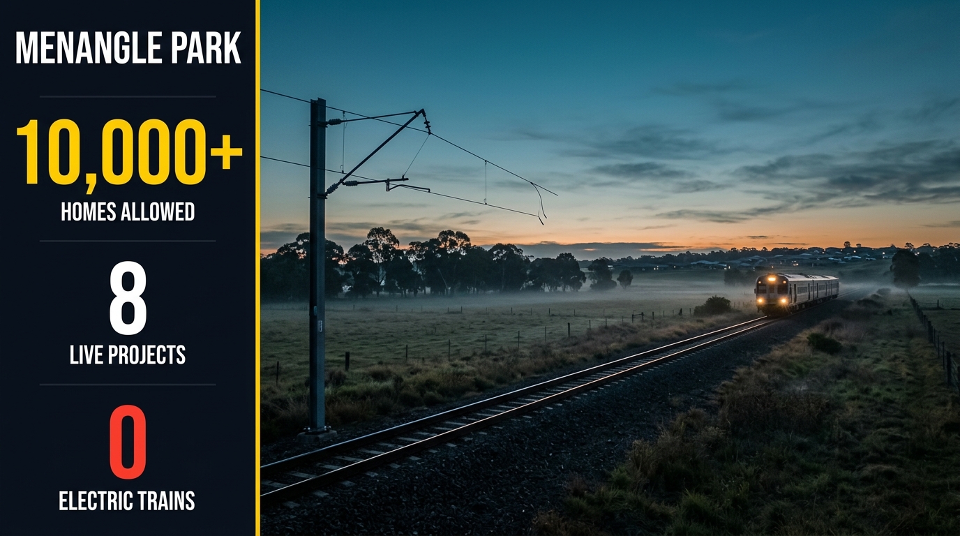
Menangle Park development has stopped being a promise and started being a postcode you can drive through. Currently, there are 8 live projects across Menangle Park and neighbouring Mount Gilead. Together, the approved plans cover more than 10,000 homes. The latest news, in fact, came in September 2026. That’s when Transport for NSW put the Spring Farm Parkway Stage 2 design on display. A month earlier, a development application also landed for the suburb’s first town centre, with 2 supermarkets and an indoor pool. But the biggest swing factor is still on paper. A plan for 1,907 apartments next to the station, for example, is still waiting on the state.
This article was produced and reviewed by the Australia Develops editorial team. See our Editorial Policy for sourcing standards and methodology.
Where is Menangle Park?
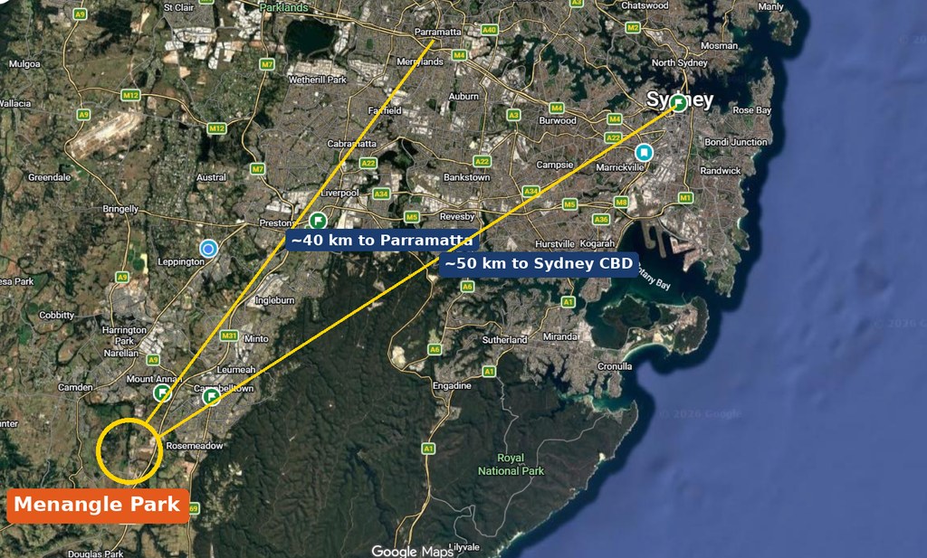
Menangle Park (2563) is in Campbelltown City Council, about 50 km south-west of the Sydney CBD and 6 km south-west of Campbelltown, with Gilead (2560) to the east. It’s on the Southern Highlands Line, but it isn’t Menangle village across the river.
Menangle Park Development — The Pipeline
First, the NSW Planning Portal, the planning panel register and Campbelltown’s DA listings were reviewed. Then the agencies building the roads and pipes were checked. In short, these are the Menangle Park development projects that are real, numbered and moving.
The 8 Menangle Park development projects at a glance
| # | Project / address | Developer | Scale | Status |
|---|---|---|---|---|
| 1 | Menangle Park release area rezoning (2017) and amendment (2022) | Campbelltown Council; DPHI | About 5,250 homes, 2,700 jobs | Rezoned; amendment in force 29 Apr 2022 |
| 2 | Dahua’s Menangle Park community, Menangle Road | Dahua Group | 4,000+ lots on 498 ha | Under construction; Stages 3 North Phase 2 and 4 North started Mar 2026 |
| 3 | Town centre, Lot 41 Menangle Road | Dahua Group | 2 supermarkets, childcare, medical, indoor pool | DA 2503/2026/DA-C lodged; under assessment |
| 4 | East Village, 182 to 232 Racecourse Avenue and nearby streets | Landowner group | 1,907 homes, 3 to 6 storeys | Council supported Dec 2025; with the state |
| 5 | 157-lot subdivision, Lot 32 Menangle Road | Not named in the listing | 157 lots plus 5 residue lots | DA 3404/2026/DA-SW lodged |
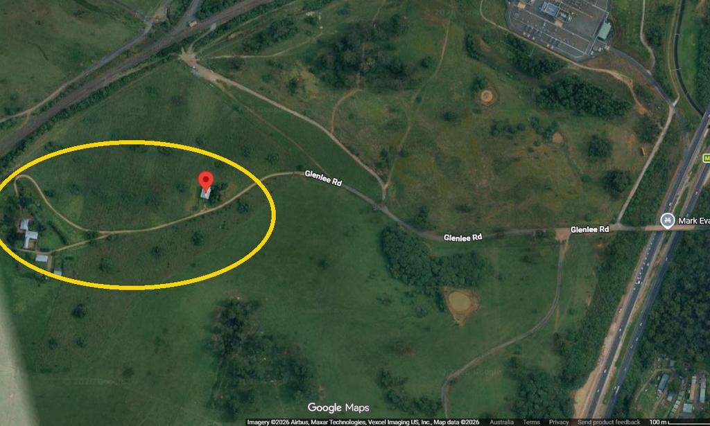
| 6 | Glenlee Estate, 60 Menangle Road | Wilson family (planning agreement) | About 50 lots around a heritage homestead | Rezoned 28 Jan 2025 (after a 2022 withdrawal) |
| 7 | Small subdivisions and childcare, Racecourse Ave, Station Rd, Taber St | Various | 14 lots, 16 lots, 1 childcare centre | Mixed: lodged, approved and returned to council |
| 8 | Figtree Hill and Gilead Stage 2, Appin Road | Stockland (Figtree Hill); Stage 2 developer unclear | 1,700 + 3,300 homes | Figtree Hill selling; Stage 2 rezoned Jun 2024 |
Laid out like that, the split is clear enough: two very large estates doing most of the delivery, a town centre and a few small infill sites filling in around them, and one project that collapsed before it started. The headline numbers behind those rows are worth separating out.
Where the Projects Sit
Numbers only go so far without geography. Menangle Park is a pocket bounded by the railway line, Menangle Road and the Nepean River, and almost every project above sits inside it or immediately across Appin Road, so the overview below is the quickest way to place them.
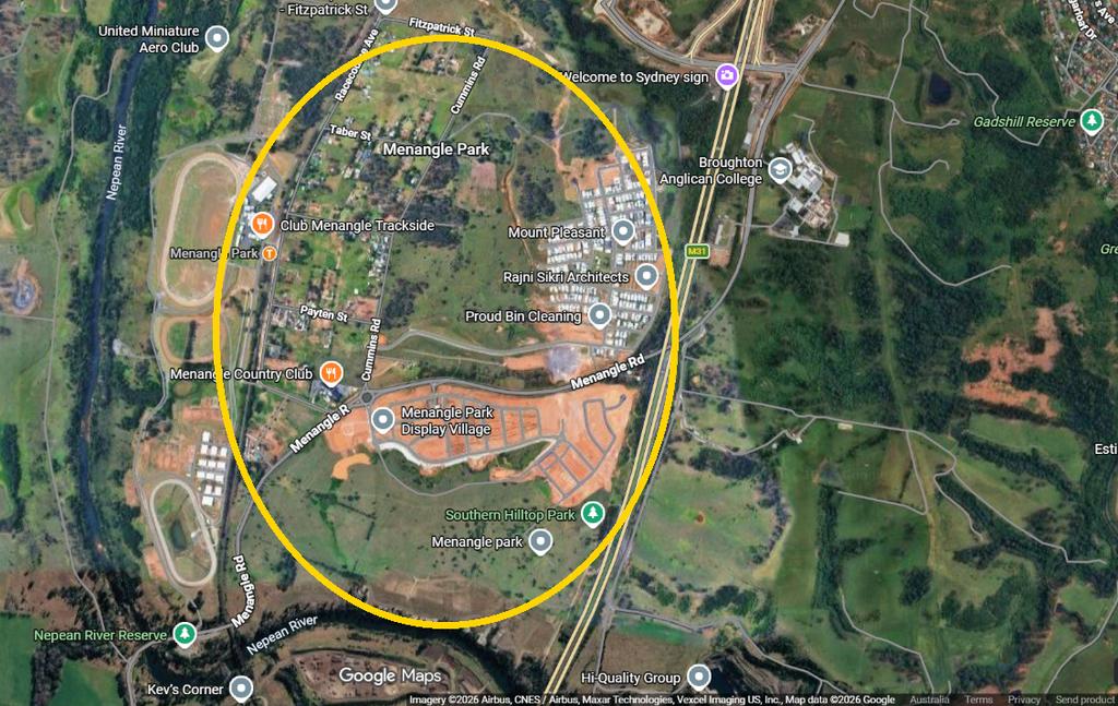
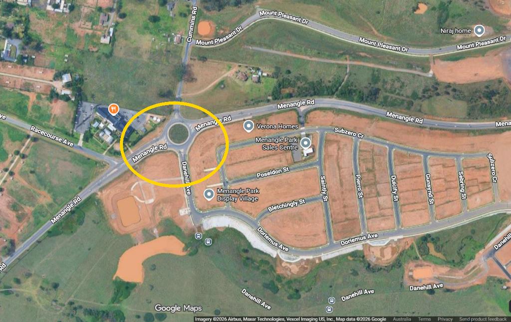
Think of Menangle Road as the spine of the whole Menangle Park development area. Dahua’s estate now fills most of the land west of it, rolling down towards the Nepean River. The Glenlee and Ridgeline precincts are in the north, while Menangle Park South sits near the river crossing. Next, the old village grid sits around the station, on Racecourse Avenue, Taber Street, Fitzpatrick Street and Station Road. That is also where East Village and the small infill subdivisions are. Then the Hume Motorway cuts north to south. Gilead and Figtree Hill, in turn, sit on the far side, along Appin Road. Spring Farm Parkway runs west from Menangle Road over the motorway, so it ties the whole area together.
PROJECT 1 — The Menangle Park development rezoning: about 5,250 homes
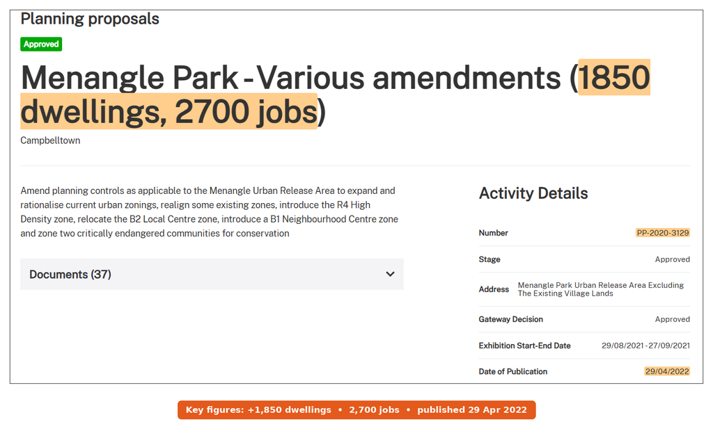
Status: Rezoned (November 2017); amendment approved and published 29 April 2022 (PP-2020-3129)
Location: Menangle Road, Menangle Park NSW 2563 and the land either side. Campbelltown City Council was the planning authority, and the change also amended the Campbelltown Local Environmental Plan 2015.
This is the rezoning every other project hangs off. Initially, on 22 November 2017, the state rezoned 960 ha at Menangle Park. Landcom’s release at the time said “up to 3,000 new homes”. So that’s the number you’ll still see on older sites. It also flagged a road link to the Hume Motorway, which later became Spring Farm Parkway.
How the 2022 amendment lifted the home count
Then the numbers grew. Dahua, which bought the bulk of the land in a 2015 government tender, later asked for a bigger and denser plan. The Planning Portal record titles it “Menangle Park – Various amendments (1850 dwellings, 2700 jobs)”. In particular, it added an R4 high density zone and moved the local centre. It also brought in a neighbourhood centre and zoned 2 critically endangered bushland communities for conservation. Eventually, after exhibition from 29 August to 27 September 2021, the state published it on 29 April 2022. Dahua’s planners now describe up to 5,250 homes for about 16,300 residents.
So what does that mean for you? In short, most of the land is already zoned. So the big fights about whether Menangle Park should be a suburb are over. What’s left now is staging, roads and the denser pockets near the station.
PROJECT 2 — 4,000+ lots in Dahua’s Menangle Park development off Menangle Road
Status: Under construction (Stage 3 North Phase 2 and Stage 4 North started March 2026; due early 2027)
Location: Lot 41 Menangle Road, Menangle Park NSW 2563, the parent lot behind most of the estate’s DAs. The developer is Dahua Group, which also built at Edmondson Park. Currently, Dahua’s project page lists 498 ha, 41 ha of open space and “4,000+ lots”.
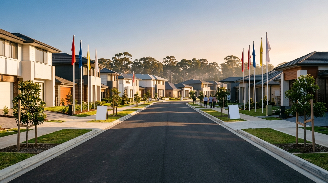
Here’s the sequence so far. Stages 1 and 2A came first, and together with Stage 2 they delivered more than 300 lots. Stage 3 South then added a planned 331 lots. Next, Stage 3 North wrapped up civil works in 2025. The display village also opened in June 2025, with 34 homes from 26 builders. Then in March 2026, Dahua started Stage 3 North Phase 2 (WEM Civil) and Stage 4 North (TRN Group). It now expects both to finish in early 2027, which opens the way for titles and settlements. It’s also selling Stage 7 as the “Glenview” release in the Glenlee precinct, with lots from 250 to 600 m².
Applications queued for the next stages
The council DA list also shows what’s queued behind that. In particular, these Menangle Park development applications were found on Lot 41 Menangle Road:
- 6438/2025/DA-SW: Stage 6A, with 104 lots, 4 residue lots for later housing, and 2 lots for a creek corridor and park.
- 1137/2025/DA-SW/A: a change to Stage 5B, covering 86 lots plus 6 residue lots in 5B-1 as well as 13 lots in 5B-2.
- 3292/2025/DA-SW/A: a change to a consent for 6 super lots and roads.
- 1785/2025/DA-SW/A: a change to a 4-lot subdivision that also carries the Spine Road and its Howes Creek bridge.
- 3574/2019/DA-CW/A: a change to the site-wide bulk earthworks consent.
Next door, at Lot 31 Menangle Road, a modification (4057/2018/DA-SW/G) covers Stage 3 with 328 lots. Dahua also signed a planning agreement with the council. The council’s summary currently values everything at $201,753,200.55, including land. For example, it includes 2 bridges over Howes Creek and playing fields at Ridgeline. It also covers a community centre site and bus stops in all 3 precincts.
One practical tip. With 26 builders on display, of course, quality varies. So before you sign a build contract here, run the builder licence and disciplinary check. It takes 10 minutes.
PROJECT 3 — Menangle Park town centre with 2 supermarkets at Lot 41 Menangle Road
Status: Under assessment (DA 2503/2026/DA-C lodged with Campbelltown City Council in 2026)
Location: Lot 41 Menangle Road, Menangle Park NSW 2563. The applicant is Dahua’s team, while Woolworths is the named anchor.
This is the one locals have waited for. In fact, the application describes “a mixed-use town centre including a full-line supermarket” plus a mini-major supermarket. It also covers speciality shops, food and drink, childcare and a medical centre. In addition, there’s an indoor recreation centre with a pool. In March 2026, Dahua said it was still preparing the DA, so the lodgement is recent.
How big will it be? The council listing, however, doesn’t give floor space or cost. Instead, the best guide is the 2021 market study lodged with the rezoning. It modelled 28,258 m² of floor space at full build and about 1,000 jobs. Its first stage, for example, had up to 10,000 m² of shops. Still, those are best treated as targets, not the DA’s numbers. If the cost tops $30 million, the Sydney Western City Planning Panel decides instead of council staff. So watch the panel register too.
PROJECT 4 — East Village: 1,907 homes near Menangle Park station on Racecourse Avenue
Status: Council supported (December 2025); awaiting a state Gateway decision
Location: 182 Racecourse Avenue, Menangle Park NSW 2563 and neighbouring lots on Fitzpatrick Street, Taber Street and Cummins Road. Michael Brown Planning Strategies lodged the request for a group of landowners. The site covers 19 ha.
This is the most contested Menangle Park development, so its story is worth knowing. Right now the land carries R2 low density zoning with 420 m² lots. By contrast, the original 2022 request sought R3 and R4 zones, heights up to 27.5 m and up to 2,179 units. Council first looked at it in November 2022 and deferred it.
Why council staff first said no
By June 2025 the plan was down to 2,073 homes, and staff still recommended against it. Their reasons were specific. For example, the yield was “not supported”, the design and open space fell short, and infrastructure wasn’t covered. They also flagged that trains on this line don’t run on electric power south of Macarthur, and services are sparse. Yet staff accepted there was strategic merit in more density near a station.
So the landowners came back with a smaller plan. It cut the homes to 1,907 and dropped the tallest buildings from 6 to 8 storeys down to 3 to 6. It also lifted open space from 2.4 ha to 4.1 ha. Then, at its last meeting of 2025, council voted to support it, with 2 Greens councillors against. Next, the state decides whether it goes to exhibition. Even if it does, the first apartment block is still years away.

PROJECT 5 — 157 new lots at Lot 32 Menangle Road
Status: Lodged (DA 3404/2026/DA-SW, Campbelltown City Council); no decision published yet
Location: Lot 32 Menangle Road, Menangle Park NSW 2563. However, the public listing doesn’t name the applicant.
This is a newer, quieter piece of the Menangle Park development puzzle. It seeks 157 residential lots and 5 residue lots, as well as internal roads, stormwater, site works and landscaping. Because it’s a 2026 number, it sits in the current assessment queue. It also sits next to Lot 31, which carries the 328-lot Stage 3 consent. So expect it to join the streets Dahua is building there. The developer could not be confirmed, so this will be updated once council publishes the decision.
PROJECT 6 — About 50 lots around Glenlee House at 60 Menangle Road
Status: Rezoned (PP-2023-1841 published 28 January 2025); an earlier version (PP-2021-4123) did not proceed in March 2022
Location: 60 Menangle Road, Menangle Park NSW 2563. The planning agreement names William and Patricia Wilson as the developer, signed with council on 12 November 2024.
Glenlee House is a State heritage homestead on 17.86 ha. The first attempt to rezone it gained Gateway approval in July 2021. Then the department stopped it on 9 March 2022, with “do not proceed” letters to council. The Planning Portal doesn’t publish the reasons, so they are not guessed here.
However, the second version went through. The Planning Portal record shows exhibition from 27 March to 10 May 2024 and publication on 28 January 2025. In other words, it moves the site from 1 dwelling to about 50. That’s 24 environmental living lots and 26 medium density lots. It also zones the homestead for heritage protection and hands a ridge-top park to council at no cost.

A rezoning record tells you what is now permitted on the land. It does not tell you what is actually there, so it is worth looking at the site itself before picturing 50 lots on it.
PROJECT 7 — Small subdivisions and a childcare centre in the old village
Status: Mixed (14-lot DA lodged 2026; 16-lot planning agreement signed May 2023; childcare DA returned to council by the panel)
These are small, but they’re the projects closest to existing homes, so neighbours notice them first.
- 152 Racecourse Avenue: DA 3383/2026/DA-SW seeks to clear the site for 14 Torrens title lots and a new road. It’s lodged, but there’s no decision yet.
- 11 Station Road: DA 2407/2022/DA-SW covers about 16 lots. Its state planning agreement, signed 8 May 2023, also adds $12,000 per lot (indexed) towards state infrastructure.
- 12 Taber Street: DA 3226/2025/DA-C proposes a single-storey childcare centre worth $5.03 million. It initially went to the planning panel as PPSSWC-667 in December 2025. The panel register now shows it as “Returned to council”, so council staff will decide it.
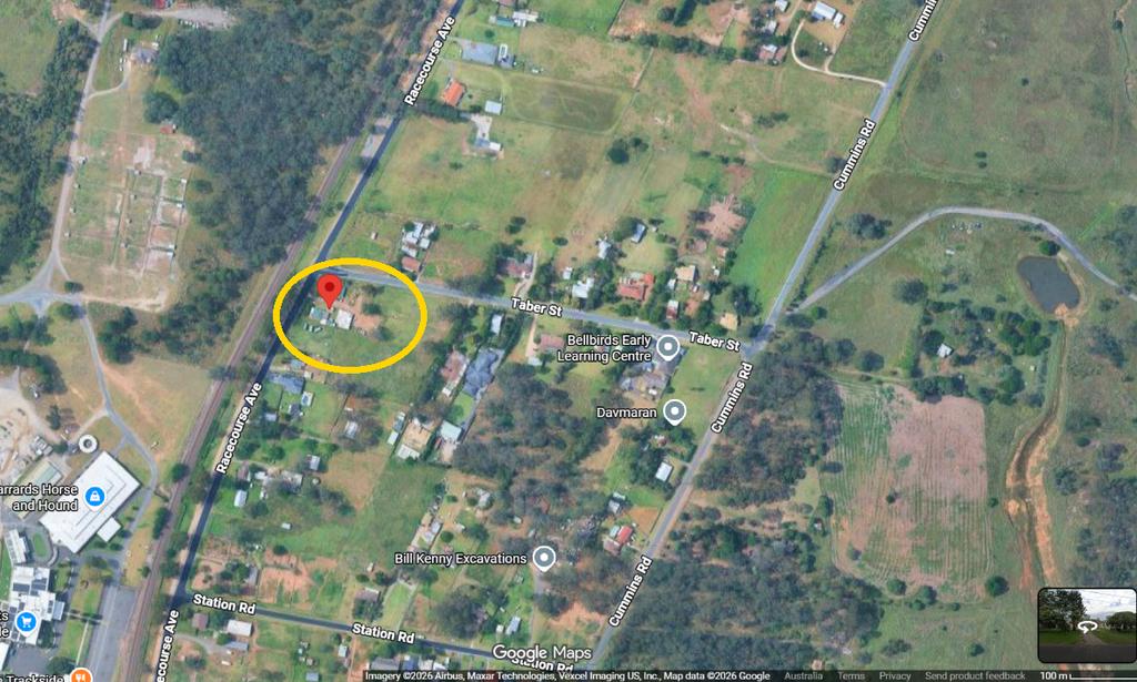
The childcare proposal sits on a separate block a few streets away, in the older part of the village rather than on the new estate land.

PROJECT 8 — Figtree Hill and Gilead Stage 2: 5,000 homes along Appin Road
Status: Figtree Hill approved 2019 and selling; Gilead Stage 2 rezoned 5 June 2024 (PP-2022-3978); land deal lost in court December 2025
Location: Appin Road, Gilead NSW 2560, on the historic Mount Gilead estate east of the motorway. Lendlease started Figtree Hill, and Stockland now sells the lots.
Figtree Hill is the first stage, approved in 2019 for 1,700 homes. Gilead Stage 2, however, is the bigger one. The Planning Portal record says it seeks “to facilitate approximately 3,300 dwellings” on 495 ha. The state then published it on 5 June 2024. In fact, about half the land is conservation zoning, with 230 ha of mapped koala corridors. The department’s Gilead page adds a catch: 600 homes can go ahead now, but the other 2,700 wait on infrastructure.

How the Gilead Stage 2 land deal fell apart
Then the deal behind it fell apart. Initially, Lendlease had agreed to buy the land in stages for $200 million. But it missed a June 2024 sunset date on the first Stage 2 parcel, because a rezoning condition wasn’t met. As a result, the Supreme Court ruled it had lost the right to buy the rest. Later, in December 2025, the Court of Appeal dismissed its appeal with costs. Lendlease said it was “considering the position”. As of October 2026, no public announcement of a new developer for Stage 2 was found. So the zoning is in place, but who builds it is unknown. Gilead will be covered in more depth in a separate post.
The Infrastructure Behind the Growth
Roads and pipes, after all, decide how fast any Menangle Park development happens. Here’s what’s funded and what isn’t.
Spring Farm Parkway and the new Menangle Road intersection
Spring Farm Parkway Stage 1 (done). The $206 million first stage opened to traffic in August 2024. It’s a 4-lane divided road from Menangle Road over the Hume Motorway. At opening, the state expected about 10,000 vehicles a day. Private developers as well as 2 state acceleration funds paid for it.
Spring Farm Parkway Stage 2 (design only). This is the 3 km, 4-lane extension west to Liz Kernohan Drive in Spring Farm. From there, it then links to the Camden Bypass. On 7 September 2026, the state and federal governments released the design, backed by $15 million for planning. Feedback on the Review of Environmental Factors later closed on 27 September 2026. But there’s no construction money. In fact, the Transport for NSW page marks design, tender and construction “subject to funding”.

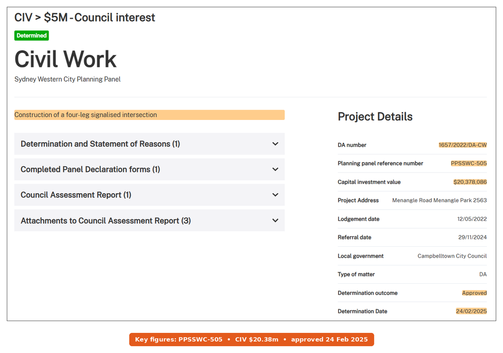
Menangle Road and Spine Road intersection (approved). Dahua’s application 1657/2022/DA-CW, worth $20,378,086, is a 4-leg signalised intersection. The Sydney Western City Planning Panel then approved it unanimously on 24 February 2025 (PPSSWC-505). It’s a works item under Dahua’s planning agreement, and it will also be the main entry to the town centre.
School, water and power for the Menangle Park development
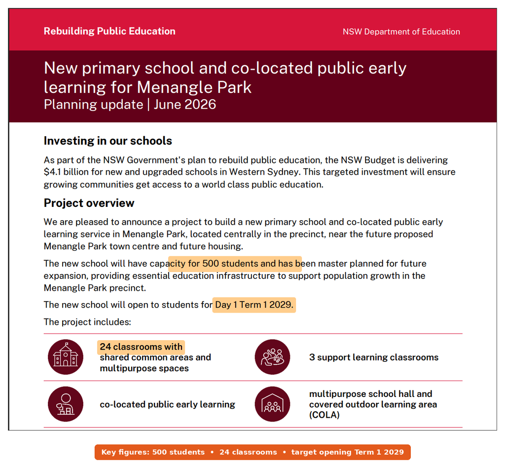
New primary school (funded, in design). School Infrastructure NSW plans “a new primary school for 500 students” with a public preschool on site. The plan also includes 24 classrooms, 3 support classrooms, a hall and a full-size playing field. Currently, Dahua is handing the land to the state. Then the planning application goes out for comment in late 2026. The June 2026 update targets Day 1, Term 1, 2029 for opening.
Water and sewer (under construction). The 2025-26 NSW Budget lists $62.9 million for Menangle Park wastewater, supporting about 4,000 lots. Sydney Water is building a new pumping station at Menangle Road and Danehill Avenue, due late 2026. It’s also upgrading the station north of Fitzpatrick Street. Then a 2 km drinking water main to Menangle should finish by mid-2027.
Power (planned). Endeavour Energy plans a permanent substation on Fitzpatrick Road, fed by a new 66kV underground line from Macarthur. In fact, it says the temporary unit won’t cope with demand beyond 2027. Still, it hasn’t published dates or a budget yet.
Appin Road upgrades and the unfunded rail line
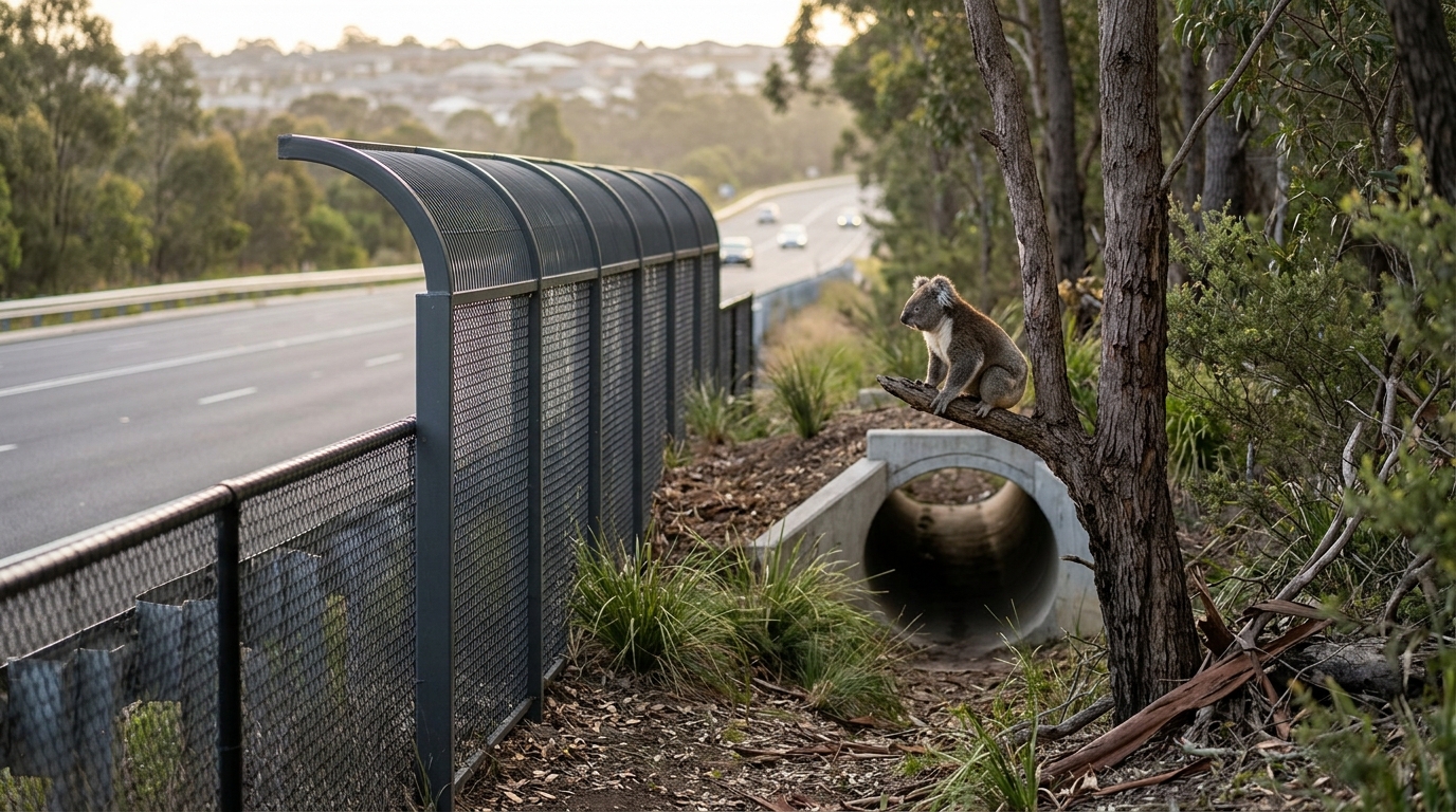
Appin Road (Stage 1 done). Transport for NSW finished Stage 1 between Rosemeadow and Gilead in March 2026. It also added new Figtree Hill intersections, koala fencing and a koala underpass. Stage 2, however, is only at concept design, and the Budget shows $138 million over 4 years for Appin Road upgrades.
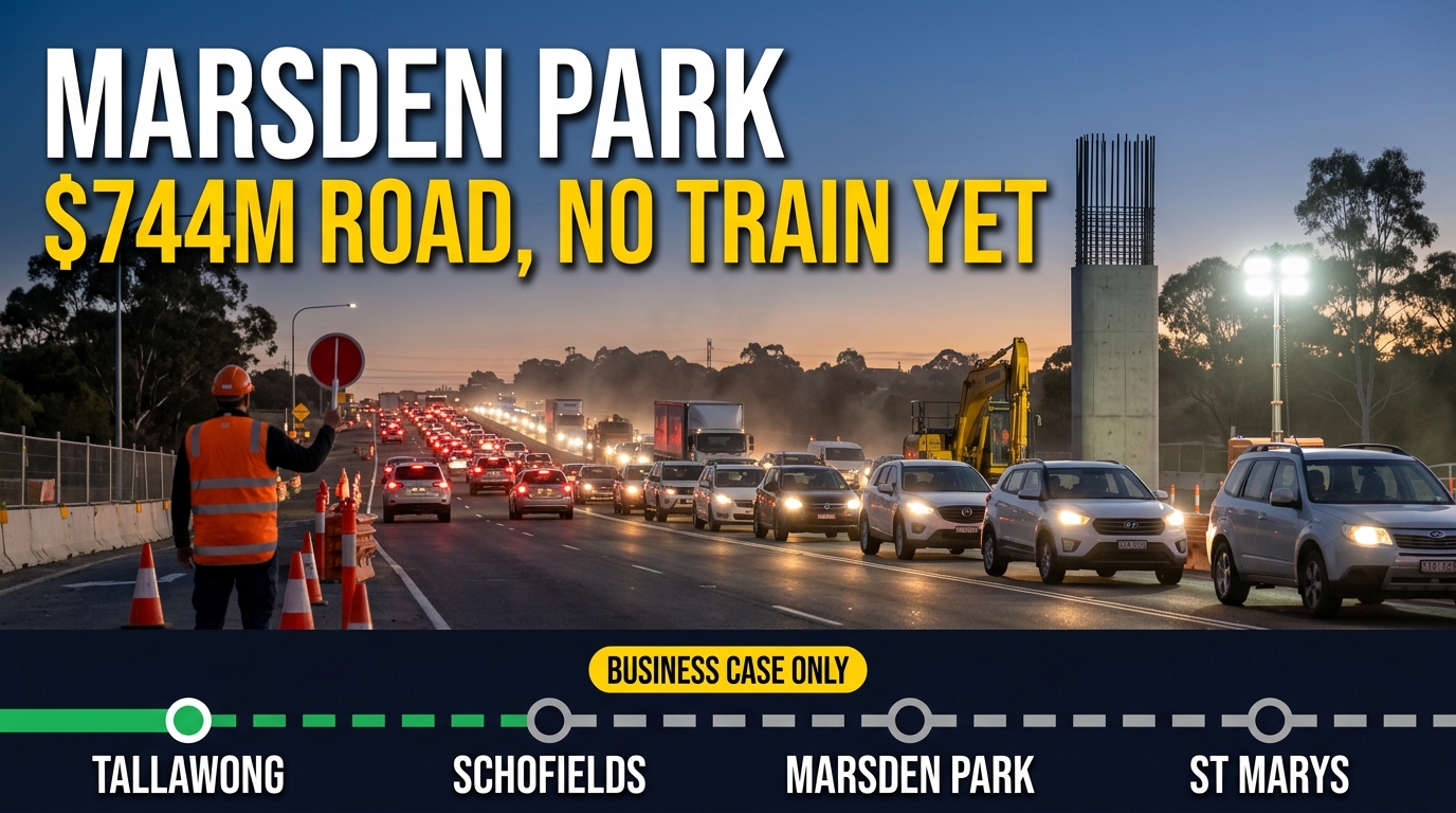
Rail (no upgrade funded). Menangle Park station dates from 1937 and has 2 short platforms. Currently, Southern Highlands Line trains stop there. But the overhead wires end at Macarthur, so no electric Sydney Trains services run here. Transport did dig and survey at nearby Menangle station in September 2026 to prepare for new trains. Still, nobody has funded electrification or more services to Menangle Park.
What’s Next to Watch in Menangle Park Development
The next 12 months should bring a lot of firsts. Here’s what to watch.
- The next step for the town centre is council’s assessment of DA 2503/2026/DA-C. Then watch for its exhibition and whether the planning panel picks it up.
- The school’s planning application goes on public display in late 2026, with a community session in Term 4. That’s also your chance to see the design.
- Sydney Water currently expects both pumping station jobs to finish in late 2026. That, in turn, lets more lots connect.
- Dahua’s Stages 3 North Phase 2 and 4 North are due in early 2027, so titles and settlements should follow.
- Next, Transport will publish a determination report on Spring Farm Parkway Stage 2. After that, watch the 2027 state and federal Budgets for construction money, because nobody has committed any yet.
- For East Village, watch the Planning Portal for a Gateway decision as well as exhibition dates.
- At Gilead, watch for news on who takes over Stage 2, as well as the design for Appin Road Stage 2.
Project Status and Delivery Timing
| Project | Homes | Stage | Decision maker | Expected timing |
|---|---|---|---|---|
| Release area rezoning | About 5,250 | In force | DPHI / Campbelltown Council | Done (2017, 2022) |
| Dahua community stages | 4,000+ lots | Construction | Campbelltown Council | Stages 3N and 4N early 2027; more stages after |
| Town centre | None (retail, pool, childcare) | DA under assessment | Council or planning panel | Decision not dated |
| East Village | 1,907 | Council supported | DPHI (Gateway) | Gateway not dated; building years away |
| Lot 32 Menangle Road | 157 lots | DA lodged | Campbelltown Council | Not stated |
| Glenlee Estate | About 50 | Rezoned | Campbelltown Council (DAs) | No DA located yet |
| Village infill and childcare | 30 lots; 1 centre | Mixed | Campbelltown Council | Not stated |
| Figtree Hill and Gilead Stage 2 | 1,700 + 3,300 | Selling; rezoned | Council and DPHI | Stage 2 developer unknown |
Editorial take
Menangle Park development now has the hard parts done. The land already has its zoning, while Dahua is building the estate stage by stage. Sydney Water is also laying the pipes, and the school has a target year. A supermarket-anchored town centre is now a lodged DA rather than a picture in a brochure. That’s real progress compared with a few years ago, and it’s the reason this area deserves to be taken seriously. You can see a similar pattern in Glenfield further up the line, though Glenfield has the trains Menangle Park lacks.
That said, the weak spots are transport and timing. Spring Farm Parkway Stage 2 has a design but no construction money. The station also has no electric services and no funded plan to get them. In fact, that’s the same issue that held up East Village. Then Gilead Stage 2 has zoning but no builder. So the case for buying here rests on the land, the school and the shops on the way. But a train upgrade nobody has funded is not a reason to buy. For the wider region, the Campbelltown and Macarthur development guide also covers the hospital and renewal pipeline. In addition, Wilton New Town is the next big release further south.
Questions locals are asking
When will Menangle Park get a supermarket?
There’s no confirmed date yet. The town centre DA (2503/2026/DA-C) includes a full-line supermarket as well as a smaller one, and Dahua names Woolworths as the anchor. It still needs approval, and then construction. Until then, Macarthur Square and Spring Farm are the closest big shops.
Will Menangle Park station get electric trains?
Not under any funded plan. Only Southern Highlands Line trains stop at the station, because the wires end at Macarthur. In fact, council staff raised this exact point in June 2025 when they assessed East Village.
Where will local kids go to school?
The state plans a public primary school for 500 students in the middle of the estate, near the future town centre. For now, School Infrastructure NSW’s June 2026 update targets Term 1, 2029. Until it opens, families will use existing schools in Campbelltown and Spring Farm.
What does stamp duty look like on a Menangle Park block?
It depends on the price and whether you’re a first home buyer. NSW also has separate thresholds for vacant land. The stamp duty by state guide sets out the 2026 NSW concessions. So check it before you sign a land contract.
Related guide: Lowes Creek Maryland Development: Every Project and Status
This article is general information based on NSW Planning Portal records, Campbelltown City Council listings, Transport for NSW, School Infrastructure NSW, Sydney Water and developer announcements available at publication. It isn’t financial advice. Approvals and timelines can change, so check current details with council and the developer before you buy.