Western Sydney Airport property hotspots require zoning-first analysis, not suburb-name speculation. The airport corridor covers enterprise land, flight-noise controls, metro access, and residential growth areas.
Written by Daniel Whitfield, founder of Australia Develops, who has personally bought, subdivided, and built property across Australia.
For Western Sydney Airport property hotspots, commercial real estate yields now depend on infrastructure staging. Institutional investment infrastructure commitments also shape rental demand. Meanwhile, aerotropolis precinct land banking remains highly sensitive to zoning and utility timing.
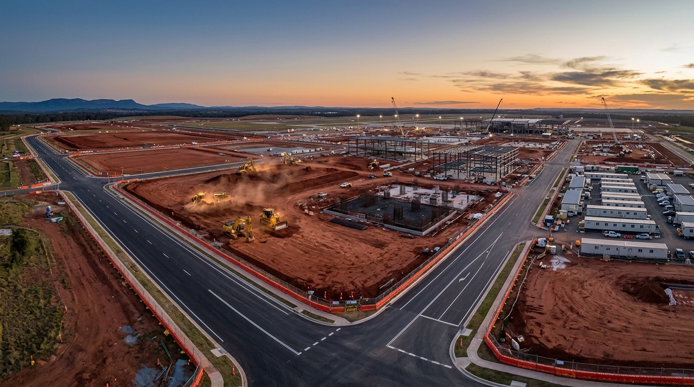
First of all, the construction of Western Sydney International (Nancy-Bird Walton) Airport (WSI) represents a major structural transformation in the layout of metropolitan Sydney.
Extensive state and federal funding outlays, this greenfield megaproject has accelerated the transition of the outer western periphery from rural-residential landholdings to high-intensity industrial, commercial, and medium-to-high density residential urban hubs.
Property researchers tracking these infrastructure corridors is essential to understanding long-term capital allocation shifts across the outer western ring.
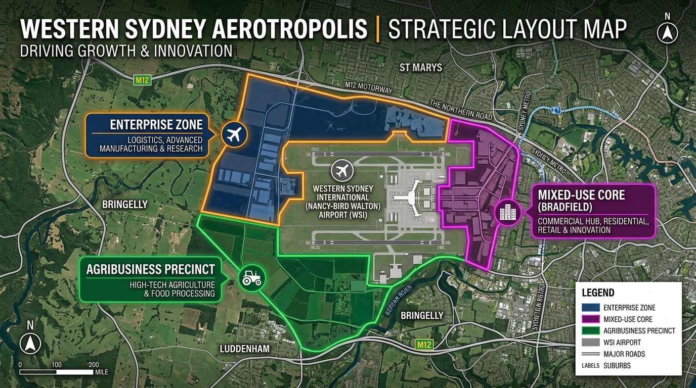
Navigating the land-use frameworks surrounding a 24-hour infrastructure asset requires an objective understanding of regional zoning matrices, environmental constraints, and delivery timelines.
For example, broad geographic generalisations can be highly misleading; specific precinct rules determine whether a land allotment will support high-density development or remain strictly restricted due to aircraft noise corridors.
Accordingly, the table below outlines the core planning precincts established under the Western Sydney Aerotropolis Plan, illustrating the structural divisions implemented across the impact zone.
1. Aerotropolis Land-Use Snapshot
Mixed-use, technology and advanced manufacturing
Enterprise, freight and logistics activity
Agribusiness and employment uses
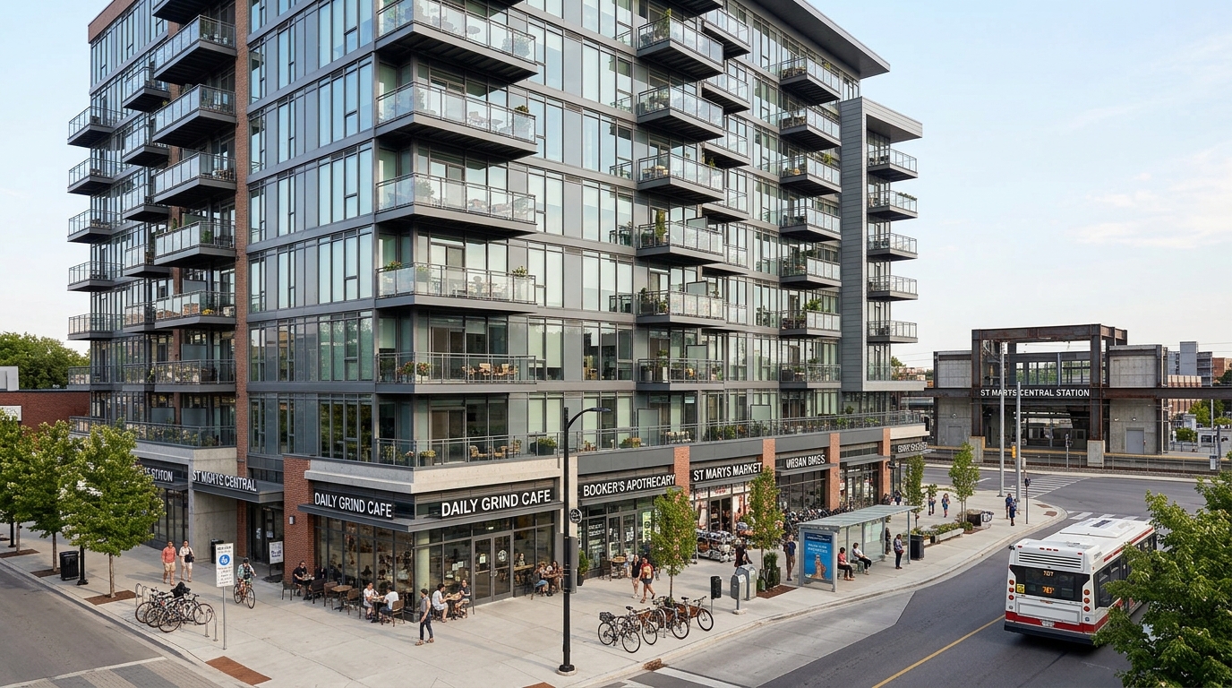
Transit-oriented housing around St Marys
First: the zoning label matters more than straight-line distance from the runway.
| Precinct Name | Primary Land Use Allocation | Core Infrastructure Driver | Development Intent |
|---|---|---|---|
| Aerotropolis Core | Mixed-Use / High-Tech | Bradfield Metro Station | Advanced manufacturing, commercial offices, aerospace, and defense hubs. |
| Badgerys Creek | Enterprise / Light Industrial | WSI Cargo Gate / M12 Corridor | High-throughput logistics, 24/7 warehousing, and cold-chain storage. |
| Bringelly | Agribusiness / Mixed Enterprise | The Northern Road Upgrade | Agricultural processing, freight logistics, and fresh food export facilities. |
| St Marys | High-Density Residential / TOD | Sydney Metro Interchange | Transit-oriented residential apartments and established retail expansion. |
Comparing Western Sydney Airport Property Hotspots with an Established Growth Corridor
For comparison, investors assessing these emerging Western Sydney Airport property hotspots often benchmark them against established Western Sydney growth corridors that have already moved through the speculation-to-delivery cycle. For instance, Bankstown CBD’s $3.9 billion active development pipeline offers a useful comparison: a precinct that received early infrastructure commitment (Sydney Metro and hospital expansion) and has since converted that commitment into completed, revenue-generating assets.
The video below examines how Bankstown’s metro and hospital-anchored growth played out, providing a template for what a mature Badgerys Creek or St Marys precinct could look like once the Aerotropolis moves past its current construction phase.
Deciphering the Aerotropolis Plan: Zoning Realities and Noise Overlays
First, evaluating real estate opportunities near Western Sydney Airport requires a thorough understanding of the specialized planning controls implemented by the NSW Government.
The Western Sydney Aerotropolis Plan governs more than 11,000 hectares of land surrounding the airport fence line, replacing legacy agricultural overlays with new, flexible employment and enterprise classifications designed to operate seamlessly on a 24-hour basis.
The Role of Enterprise and Mixed-Use Designations
The primary planning mechanism across the immediate airport periphery is the Enterprise Zone classification. This designation is engineered to protect the airport’s 24-hour operational capacity by prohibiting traditional low-density, detached residential housing.
In turn, the goal is to avoid the retrofitted curfew complaints that historically limited inner-city hubs like Mascot.
Permitted uses within Enterprise Zones focus heavily on logistics, warehouse distribution networks, freight terminals, and high-tech corporate manufacturing. Private buyers looking for traditional residential assets must look beyond the immediate enterprise perimeter to established or newly master-planned residential growth corridors.
Managing the Australian Noise Exposure Forecast (ANEF)
3. Aircraft-Noise Decision Bands
After that: compare each suburb by its actual infrastructure role.
Most importantly, the most critical environmental control governing residential viability in the region is the Australian Noise Exposure Forecast (ANEF) contour mapping system, because WSI will operate without a flight curfew, state planning regulations apply strict development restrictions within these contours to manage noise exposure.
ANEF 20 to 25 Contours: However, traditional residential developments face significant restrictions. Approvals are generally subject to mandatory acoustic construction standards under Australian Standard AS 2021, which requires double glazing, reinforced insulation, and specialized roof structures.
Above ANEF 25 Contours: Consequently, new residential housing is entirely prohibited. Consequently, land use within these higher acoustic thresholds is restricted to industrial enterprise, automated logistics, and commercial storage facilities that are unaffected by flight path noise.
Western Sydney Airport Property Hotspots: Suburb Analysis and Growth Corridors
The real estate dynamics across the Western Sydney growth corridor vary significantly depending on geographic positioning, utility readiness, and transport access.
The primary sub-markets can be categorized into greenfield enterprise zones, established transit hubs, and emerging master-planned residential supply valves.
Western Sydney Airport Property Hotspots: Badgerys Creek Logistics
For example, Badgerys Creek occupies the direct northern and eastern boundaries of the new airport tarmac, making it the primary focus for institutional logistics capital.
Zoning Strategy: Transitioned completely from small-scale agricultural holdings to high-capacity enterprise and light industrial use.
Significantly, What This Means: Private residential buyers are effectively excluded from this sub-market. The area is dominated by institutional developers and real estate investment trusts (REITs) consolidating large sites to build massive fulfillment centers. Foreign Direct Investment (FDI) Australia benchmarks place the Badgerys Creek logistics corridor among the highest-priority offshore capital deployment zones in the 2025–2030 cycle.
Late-stage private speculation carries high risk due to the substantial capital expenditure required for major earthworks and trunk utility connection.
Bringelly: The Southern Agribusiness Gateway
Critically, Bringelly is located directly south of the airport precinct, offering a unique mix of enterprise, agribusiness, and environmental lifestyle allocations.
In practice, Strategic Advantage: Benefits from direct access to the expanded multi-lane Northern Road, which connects the South-West growth areas to the primary airport terminal gates.
Infrastructure Reality: While the long-term planning layout is extensive, many sectors within Bringelly face a notable “infrastructure lag.” Substantial portions of land lack ready access to high-capacity sewer, water, and digital fiber networks.
Buyers must factor in multi-year utility deployment timelines before sites can achieve full operational readiness.
Western Sydney Airport Property Hotspots: St Marys Rail Access
Situated north of the airport along the Great Western Highway and the T1 Western Main Line, St Marys represents a mature, transit-oriented sub-market.
Strategic Advantage: St Marys serves as the northern transfer interchange for the driverless Sydney Metro Western Sydney Airport line. This infrastructure configuration links the existing rail corridor straight into the WSI terminal basement.
Collectively, Property Dynamic: Unlike greenfield precincts, St Marys features established amenities, operating schools, and retail infrastructure. In addition, the local council has up-zoned sectors around the station to permit medium-to-high-density multi-dwelling apartments, providing a clearer investment profile for standard residential portfolios.
Leppington and Austral: The Residential Supply Valves
For example, buyers seeking traditional house-and-land entry points, the South West Growth Area precincts of Leppington and Austral act as the primary residential accommodation centers for the incoming airport workforce.
Evidently, Planning Profile: These suburbs sit safely outside the restrictive core ANEF flight noise contours while remaining within a direct 15-to-20-minute commuting radius of the Aerotropolis employment hubs.
Accordingly, Market Dynamics: For example, these areas feature a high volume of master-planned estate releases and land subdivisions. Buyers must closely monitor supply pipelines to manage exposure to short-term vacancy variations and rental yield compression as successive stages settle.
Western Sydney Airport Property Hotspots: Strategic Decision Matrix
6. Capital Alignment Matrix
Prioritise permitted housing, transport and services.
Prioritise employment zoning and tenant demand.
Prioritise registration, utilities and staging.
However: every strategy still needs a risk-control checklist.
Beyond this, To assist property buyers in assessing their risk parameters and investment objectives, the table below provides a decision matrix matching specific buyer profiles with appropriate Western Sydney precincts and asset classifications.
| Investor Profile | Recommended Target Precinct | Primary Asset Focus | Identified Structural Risk | Required Due Diligence Priority |
|---|---|---|---|---|
| Private Income Focus | St Marys Urban Ring | Established Multi-Dwelling Units | Supply competition from new apartment approvals near the rail station. | Strata history review and walk-to-transit validation. |
| Long-Term Growth Focus | Leppington / Austral | House and Land Packages | Infrastructure rollout delays within newly subdivided estates. | Developer history validation and sunset clause scrutiny. |
| Institutional Scale | Badgerys Creek Core | Warehousing & Industrial Logistics | High capital entry barriers and corporate consolidation dominance. | Trunk utility availability and M12 connection timelines. |
| Speculative Venture | Bringelly Fringe | Small-Scale Enterprise Allotments | Lengthy utility connection lags and fragmented boundary changes. | Environmental overlay analysis and utility easement checks. |
Critical Infrastructure Risks: What Property Buyers Must Mitigate
Substantially, Deploying capital into major infrastructure growth corridors requires navigating distinct regulatory, environmental, and contractual variables. Buyers must perform rigorous due diligence to protect their investment from unexpected capital shortfalls or development friction points.
1. Structural Valuation Risk and Finance Approvals
Effectively, Lending institutions and mortgage insurers maintain strict credit guidelines within greenfield growth areas. Property valuations for newly subdivided lots or off-the-plan builds can experience notable shifts during the multi-year planning and delivery cycle.
If an independent valuation comes in below the contract price at settlement, the buyer must provide additional out-of-pocket capital to cover the shortfall.
Particularly, To understand how extensive government and corporate capital injections influence these regional land valuations, review the Australia Develops report on Western Sydney Aerotropolis investment case.
2. Off-the-Plan Registration and Title Delays
Purchasing land parcels before they are formally registered with NSW Land Registry Services introduces timeline variables. For example, delays in civil earthworks, council sign-offs, or utility connection certifications frequently push out projected registration dates.
These extended timelines can disrupt building contracts, push buyers past their initial unconditional finance approvals, and lead to rising construction costs.
To identify why off-the-plan land releases frequently face these structural registration issues, see the Australia Develops guide to unregistered land risks in Australia.
3. Soil Realities and Site Preparation Costs
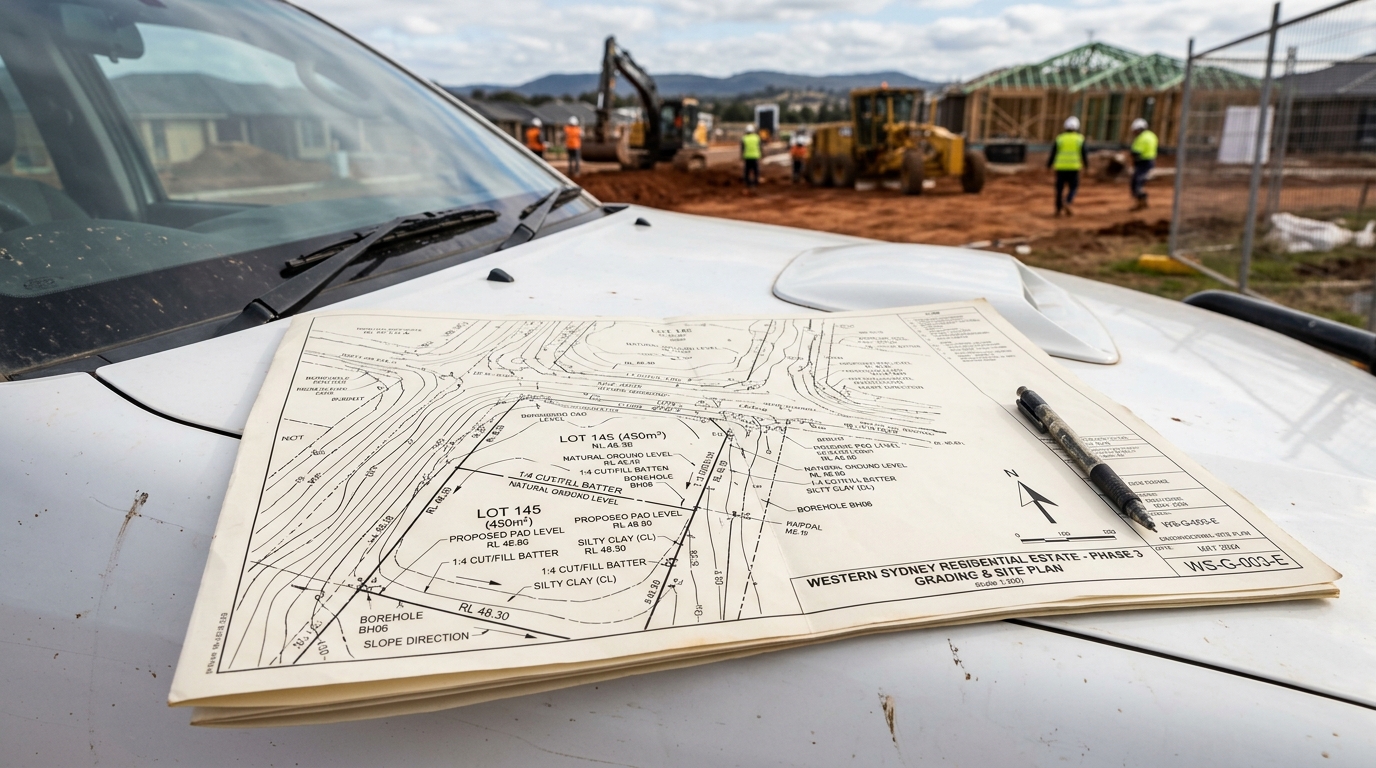
Likewise, the geographic composition of the Cumberland Plain presents distinct civil engineering challenges, including reactive clay profiles, low-lying drainage catchments, and localized salinity issues.
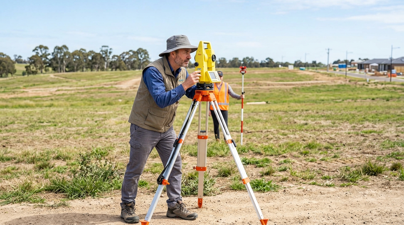
For example, unprepared buyers often execute land contracts without accounting for the site-specific costs required to lay a foundation. Engineering mandates can quickly add substantial costs for specialized concrete slabs, deep piering, and retaining walls.
For example, buyers can learn how to manage these build contract additions by reviewing the Australia Develops analysis of site costs in Australia.
4. Environmental Overlays: Flood and Bushfire Constraints
Western Sydney’s geographical basin requires careful consideration of environmental risk factors. Local environmental plans impose strict development setbacks and construction mandates on properties situated within designated flood storage zones or bushfire vegetation perimeters.
These environmental protections directly govern building insurance premiums, structural material requirements (such as high Bushfire Attack Level ratings), and ultimate council design approvals.
To access specialized mapping verification tools before finalizing a property contract, consult the Australia Develops resource on flood and bushfire mapping checks.
Key Data at a Glance: WSI Property Corridor Metrics
8. Evidence Ladder for Hotspot Claims
Establish legal land use.
Establish delivery evidence.
Establish timing and local controls.
Before deciding: use the source links below before making a property decision.
| Strategic Indicator | Value Baseline Standard | Analysis / Contextual Relevance |
|---|---|---|
| Total Planning Area | Approximately 11,200 Hectares | The scale of the Western Sydney Aerotropolis footprint. |
| Core Flight Path Constraint | ANEF 20 Contour Threshold | Controls the legal boundary for standard residential build approvals. |
| Initial Passenger Target | 10 Million Passengers Annually | Establishes the consumer base driving local commercial retail demand. |
| Long-Term Employment Goal | 100,000+ Permanent Jobs | Drives the underlying residential rental demand in surrounding suburbs. |
Tracking the performance of these localized residential markets requires evaluating specific zoning pipelines across individual suburbs. For a comprehensive review of residential land supply and lot delivery trends in the immediate growth footprint, see the detailed Australia Develops profiles on Leppington development pipeline and Austral precinct development.
Verifying the Data — Primary Sources
Prospective buyers should verify zoning classifications against primary sources rather than secondary commentary. NSW Planning’s Aerotropolis zoning maps confirm the enterprise, employment, and residential boundaries at parcel level.
The Australian Government’s aviation planning framework documents flight path and noise-abatement controls, and construction progress on the terminal and runway is tracked directly through the Western Sydney International Airport construction portal.
Transport data further clarifies which suburbs gain genuine access rather than proximity alone. The Sydney Metro Western Sydney Airport project publishes current station and platform completion data, while Transport for NSW’s M12 Motorway project confirms the toll-free road corridor linking the M7 to the terminal precinct.
For a full breakdown of confirmed airlines, opening dates, and transport links, see Australia Develops’ analysis of Western Sydney Airport 2026.
Governance across the corridor spans multiple authorities. Consequently, the Western Parkland City Authority coordinates infrastructure sequencing across councils, while Liverpool City Council administers Aerotropolis planning controls for the northern precincts. Camden Council manages growth area planning for Bringelly and Leppington to the south, an area covered in detail in Australia Develops’ dual occupancy subdivision guide.
Cross-Checking Market and Transport Signals
Hotspot selection now requires evidence from the wider correction. For example, the Sydney property price drop 2026 analysis shows which suburbs are falling and where resilience remains.
Transport access remains a key filter for Western Sydney property selection. For example, the TOD Rezoning NSW 2026 guide explains where state-led density is changing station precincts.
Likewise, noise exposure near the flight paths is shaped directly by WSI’s curfew-free operating model, covered in Australia Develops’ WSI 24-Hour Operations analysis.
Readers weighing air travel options in the region, the Sydney Airport vs Western Sydney Airport traveller comparison breaks down curfew rules, terminal design and ground transport differences between the two facilities.
Finally, for a closer look at the architectural design behind the new terminal, the Inside WSI: Nancy-Bird Walton legacy and future airport design feature covers the building’s sustainability engineering and long-term expansion plans.
Related Reading
- Worst Builders Australia: How to Check Builder Licence, Suspension and Disciplinary Records
Next Article in the Master Series
The commercial viability of Western Sydney Airport property hotspots across the Aerotropolis is directly linked to the unique operational profile of the airport itself.
The next article in this 7-part master series provides a technical analysis of WSI’s 24-hour, curfew-free operational mandate.
That analysis examines how unrestricted night flights, automated air-freight logistics, and specialized nocturnal flight paths will impact regional business capabilities and differentiate WSI from the operational limits of Sydney Kingsford Smith Airport at Mascot.
This article is for general informational purposes only and does not constitute financial, investment, or legal advice. Seek independent professional advice before making property decisions. See our Disclaimer for details.