By the Australia Develops Editorial Team — Updated July 2026
Written by Daniel Whitfield, founder of Australia Develops, who has personally bought, subdivided, and built property across Australia.
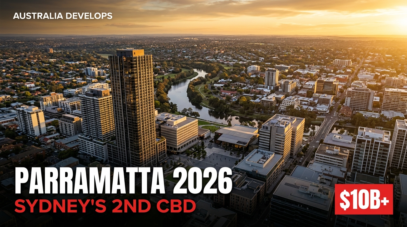
Parramatta carried Sydney’s second-CBD label for more than a decade. The 2026 transformation now exceeds that description. Parramatta Light Rail carries passengers, while Sydney Metro West targets a 2032 opening.
New planning controls remove traditional height limits. Billions in public and private investment are also entering the precinct. Parramatta is becoming a nationally significant growth centre.
This guide covers the major 2026 projects, planning changes, and verified data.
Parramatta’s rise reflects a deliberate strategy to shift Sydney’s economic centre westward. Western Sydney Airport is scheduled to open in 2026. Meanwhile, the Western Sydney Aerotropolis and Greater Western Sydney growth corridor continue gaining investment.
Parramatta sits at the strategic centre of this economic shift. Understanding Parramatta CBD development 2026 provides essential context for NSW property and planning.
The New Planning Framework: No Height Limits and FSR of 10:1
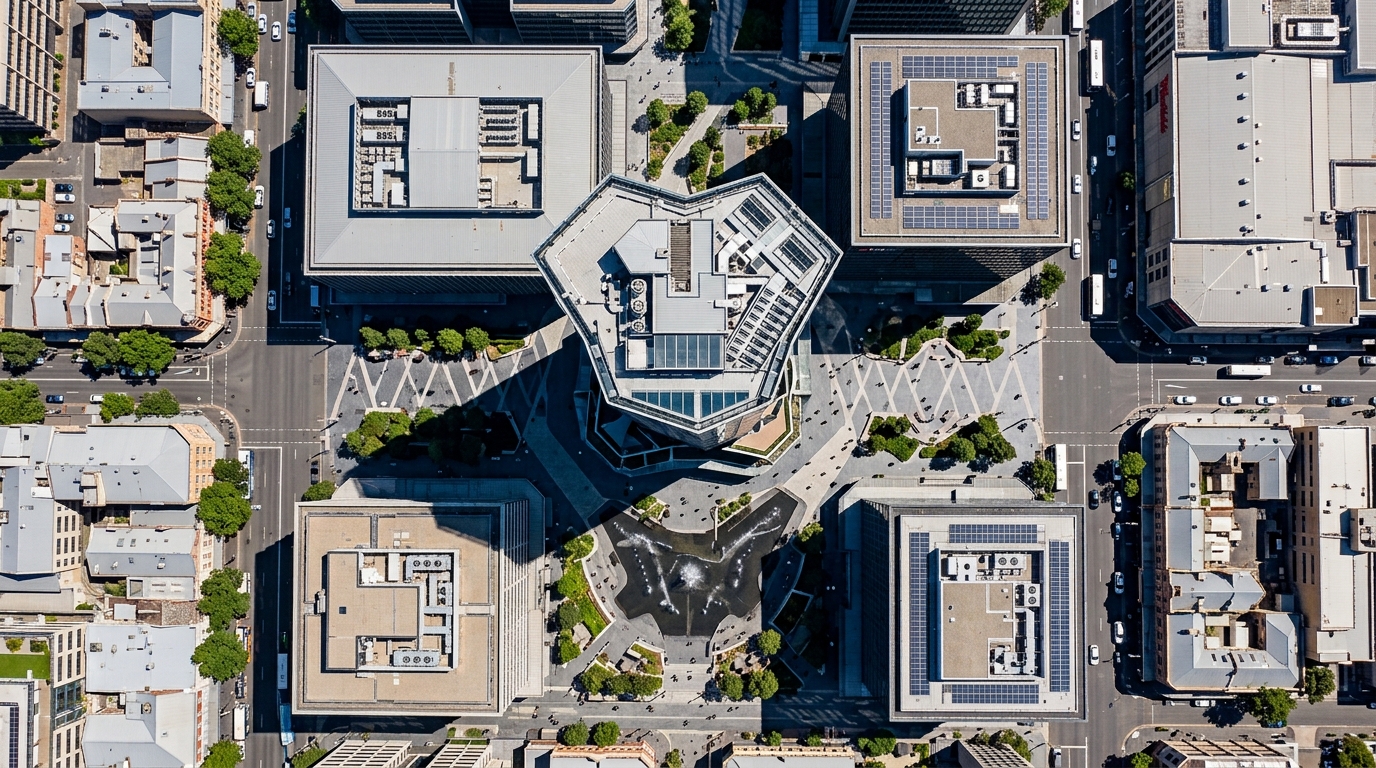
Proposed planning changes would remove traditional height limits across much of Parramatta CBD. The draft City Centre Planning Framework Review departs from conventional NSW controls. It removes prescriptive height maximums across key zones.
Sunlight, aviation, and view-impact controls would still apply. Instead, a proposed floor space ratio of 10:1 supports design excellence and growth targets.
The approach mirrors planning frameworks used in Melbourne and central Sydney. It gives designers flexibility to maximise suitable site yield. The City Centre Local Environmental Plan took effect in October 2022.
It expanded development potential and the city-centre boundary. Controls can respond more quickly to growth targets and market conditions.
This proposed framework represents a fundamental departure from conventional NSW planning controls.
Source: City of Parramatta draft City Centre Planning Framework Review.
How the New Framework Compares to Current Rules
The City of Parramatta targets 23,660 new homes by 2026. Meeting that target requires sustained high-rise development across surrounding precincts. Consequently, developers now favour housing over earlier office-led proposals.
Current market conditions make residential schemes relatively more viable. This shift also sets a precedent for Western Sydney.
Parramatta Square: Australia’s New Commercial Centrepiece
Walker Corporation developed Parramatta Square around George Street. It is Western Sydney’s largest urban renewal project. Two towers, 6 Parramatta and 8 Parramatta, provide about 125,000 square metres of premium offices.
Their combined end value is approximately $1.7 billion. Indeed, 8 Parramatta reaches 50 storeys. It ranks as Australia’s largest office tower by net lettable area. The project signals Parramatta’s ambition to attract major corporate tenants.
Major residential and mixed-use projects complement the commercial towers. At 110 George Street, planning approval covers build-to-rent and office towers.
Build-to-rent has become an emerging NSW asset class. Specific State Environmental Planning Policy provisions support density for qualifying projects.
This supply confirms Parramatta Square’s evolution into a mixed-use centre.
What’s Included in the Parramatta Square Precinct
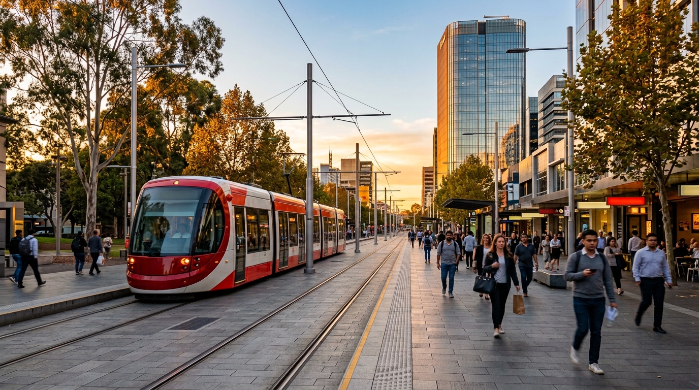
Parramatta Square serves as the precinct’s civic heart. It integrates public space, retail, cultural uses, and civic facilities. Church Street light rail now connects the square with Westmead and Camellia.
The connection improves pedestrian activity and reinforces the precinct’s mixed-use role.
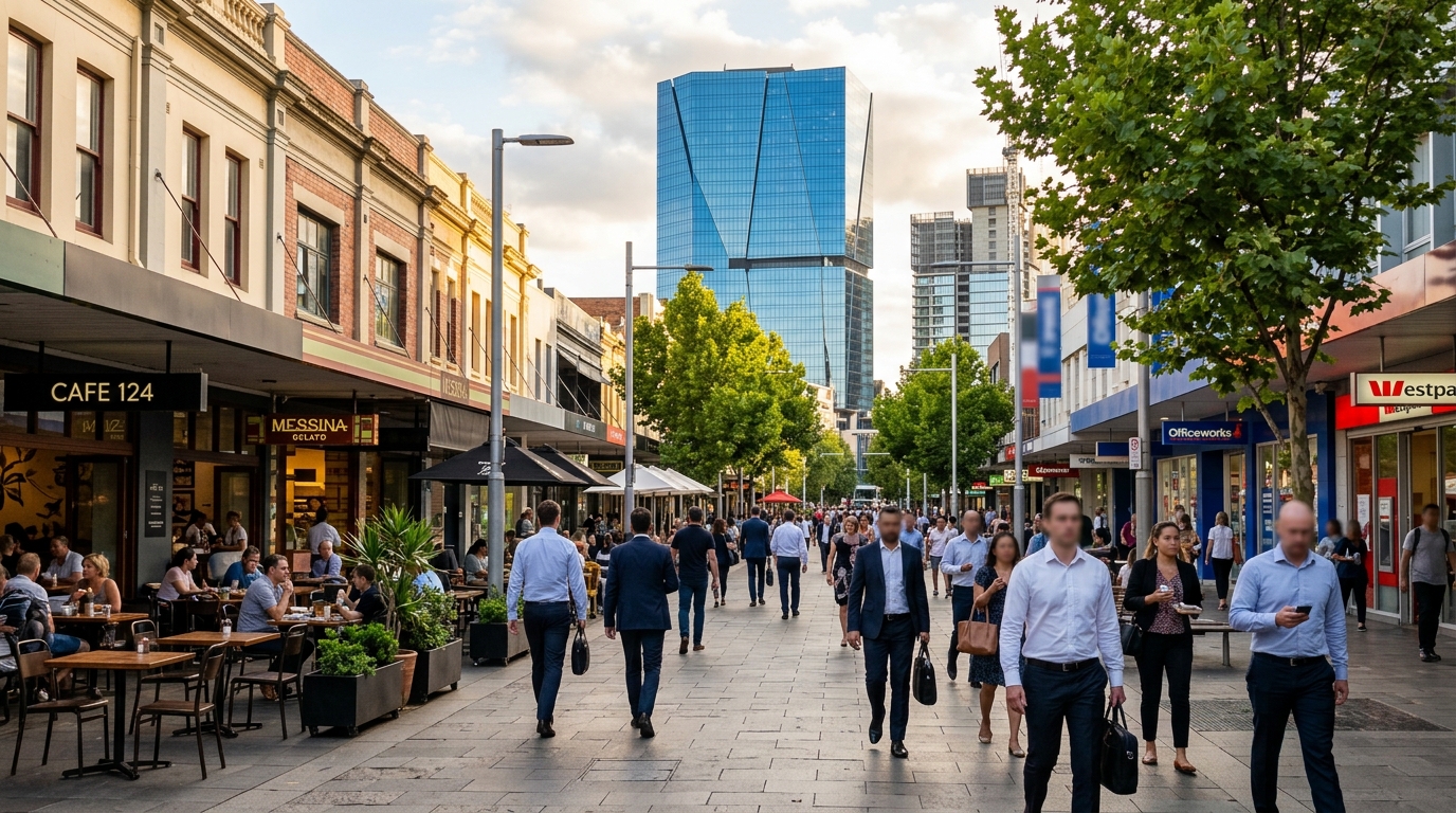
This transformation is visible on the ground as well as in the skyline, with the light rail now running directly past the towers pictured above.
This rapid pace of construction and public transport delivery is the product of a deliberate planning strategy tracked in the timeline below.
Sydney Metro West: Under Construction and Already Reshaping Parramatta
The 24-kilometre line links Parramatta with six stations on the route to Sydney CBD. These include Olympic Park, Burwood North, Five Dock, The Bays, and Hunter Street. It remains Western Sydney’s largest single infrastructure investment.
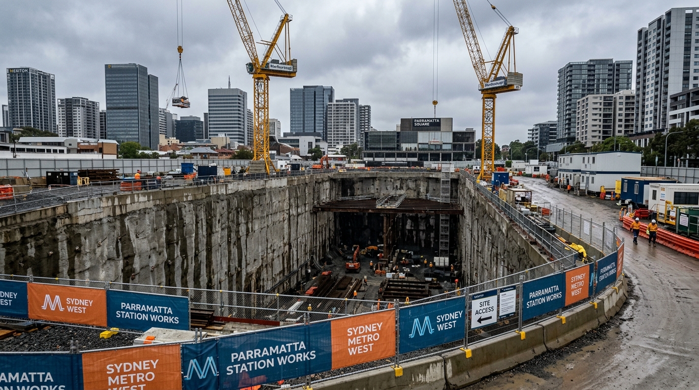
Although opening is targeted for 2032, planning activity is already substantial. The Parramatta Metro Station will occupy a central CBD block. George, Macquarie, Church, and Smith streets define its boundaries.
The scale of Sydney Metro West reflects its status as Western Sydney’s largest single infrastructure investment.
Source: NSW Department of Planning, Housing and Infrastructure, Sydney Metro.
Construction Progress and Station Integration
In 2025, the NSW Department of Planning approved the Parramatta Metro Station integrated development. The approval includes four towers. Three commercial towers reach 38, 28, and 25 storeys.
A residential tower reaches 33 storeys. Additionally, the project includes 505 parking spaces and ground-floor retail. The state expects to award the tender in 2026. Construction would enter a significant new phase.
Under the integrated model, developers fund station infrastructure and receive development rights. Government can deliver transport with less taxpayer funding. The Sydney Metro West project overview explains this delivery model.
Metro West will change Parramatta’s metropolitan connectivity. Current T1 and T2 train services already serve Parramatta Station. However, the underground alignment will cut Sydney CBD travel times to about 20 minutes.
It will also improve service frequency and reliability. Expected land-value uplift already influences acquisitions and development applications.
Parramatta Light Rail Stage 1: Open and Generating Development Activity
This metro construction activity is complemented by the light rail network already operating across central Parramatta.
Impact on Nearby Development Activity
Although Metro West remains years away, Parramatta Light Rail Stage 1 operates now. The line opened on 20 December 2024 with 16 stops. It links the CBD with Westmead, Camellia, Rosehill, and three university campuses.
Forecasts place daily patronage at about 22,000 by 2026. About 130,000 residents live within walking distance.
Light rail immediately stimulated development along the corridor. New controls allow heights up to 30 storeys along Church Street. Therefore, more housing can cluster near light rail stops.
The approach matches the broader transit-oriented development strategy. The line provides the primary connection to Camellia-Rosehill. That precinct anchors the eastern end of Stage 1. The government plans major renewal there.
Future Light Rail Expansion
Stage 2 remains in planning. It would extend the light rail network farther west. The state will assess its business case carefully. Stage 1 patronage and development outcomes will influence that decision.
Stage 1 already reshapes land use and development economics. Transport for NSW’s project page provides continuing updates.
Holdmark’s Valentine Avenue: A 233-Metre Residential Tower for Parramatta
Among current proposals, Holdmark’s Valentine Avenue scheme stands out. The $497-million project covers 2-10 Valentine Avenue. It proposes a 233-metre apartment tower. Additionally, it would convert a 13-storey office into co-living housing.
The Housing Delivery Authority currently assesses the proposal. This fast-track pathway accelerates housing delivery in supply-constrained areas.
The co-living component is notable as a relatively new residential typology in the NSW market. Co-living typically provides self-contained private bedrooms with shared common facilities, catering to young professionals, students, and key workers who may be unable to afford conventional rental accommodation in established employment centres.
Parramatta’s proximity to Westmead Health Precinct, three Western Sydney University campuses, and a growing professional services sector makes it a logical location for co-living supply. The Urban Developer’s coverage provides detail on the planning pathway and mix of uses proposed.
Camellia-Rosehill: A City-Within-a-City on the Parramatta River
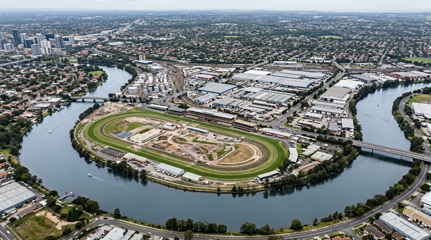
At the light rail corridor’s eastern end, Camellia-Rosehill represents a major urban renewal program. The 320-hectare precinct previously held industrial uses and Rosehill Gardens Racecourse. Plans now target a mixed-use centre.
Capacity reaches 10,000 homes and 15,400 jobs. The NSW Planning Department is preparing a formal rezoning proposal. It expects public exhibition in the near term.
Camellia-Rosehill is emerging as one of NSW’s most ambitious urban renewal programs.
Source: NSW Department of Planning, Housing and Infrastructure, Camellia-Rosehill Place Strategy.
Rezoning Process and Timeline
The Camellia-Rosehill Place Strategy outlines a new town centre, open space, paths, schools, renewable energy, and entertainment uses. Light rail places the precinct eight minutes from Parramatta CBD.
This supports two decades of housing and employment growth. However, its industrial history creates a substantial remediation challenge. Large development yields can help fund that work.
The Camellia-Rosehill rezoning also intersects with the future of Rosehill Gardens Racecourse, where the Australian Turf Club has been in discussions with the NSW Government about potential site redevelopment.
While no final decision has been publicly announced, the scale of the broader Camellia-Rosehill precinct plan makes the racecourse site a pivotal piece in Greater Parramatta’s long-term urban structure.
The Australia Develops Western Sydney Development Guide covers the broader context of precinct-level planning in this part of the metropolitan area.
Parramatta Road Corridor: 8,000 New Homes Along the Western Spine
The Parramatta Road corridor runs from Haberfield through Auburn, Homebush, and Granville. It then reaches Parramatta CBD. The NSW Government has planned its renewal for many years. Momentum returned during 2025 and 2026.
New controls will unlock up to 8,000 homes. The rezoning uses a strategic east-west corridor and existing transport.
The Parramatta Road corridor rezoning is part of the broader push to intensify housing supply along established arterial corridors, consistent with the NSW Government’s Transport Oriented Development program.
Higher-density residential development along Parramatta Road, supported by improved public realm, cycling infrastructure, and bus rapid transit services, is intended to activate what has historically been an underperforming, car-dominated corridor.
The Australia Develops guide to TOD rezoning in NSW provides comprehensive analysis of the broader program of which the Parramatta Road corridor is a component part.
Church Street North and Westmead Health Precinct
Church Street North sits immediately north of Parramatta CBD. The state rezoned it in 2023 under the Church Street North Precinct policy. Consequently, new controls allow heights up to 30 storeys.
They support housing near Parramatta Light Rail stops. The 63 Church Street proposal seeks an increase from 90 to 118 metres. That change could enable a 40-storey tower.
The Westmead Health Precinct is served by both the existing T1 rail line and the new Parramatta Light Rail.
It is one of Australia’s largest health and medical research precincts, comprising Westmead Hospital, the Children’s Hospital at Westmead, the Westmead Institute for Medical Research, and numerous affiliated facilities.
The precinct employs tens of thousands of health workers and generates significant residential demand in surrounding suburbs. Parramatta’s position as the gateway to the Westmead Health Precinct underpins the sustained demand for key worker and professional housing in the CBD and its immediate surrounds. City of Parramatta’s CBD precinct page provides the council’s current planning policy position.
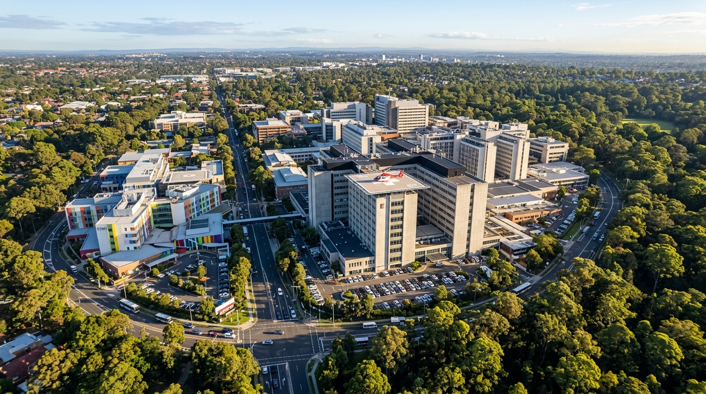
This health and research precinct sits alongside major residential renewal underway across Greater Parramatta, summarised in the investment figures below.
Key Data at a Glance — Parramatta CBD Development 2026
| Metric | Figure |
|---|---|
| City of Parramatta 5-Year Housing Target | 23,660 new homes (by 2026) |
| Camellia-Rosehill New Homes Target | 10,000 homes + 15,400 jobs |
| Parramatta Road Corridor Homes | Up to 8,000 new dwellings |
| CBD Planning Framework Max FSR | 10:1 (with design excellence) |
| Building Height Controls (CBD Core) | No prescriptive maximum (sunlight/aviation controls apply) |
| 8 Parramatta (Walker Corp) | 50 storeys, ~200m, 125,000sqm with 6 Parramatta |
| Holdmark Valentine Avenue | 233m residential tower + co-living, $497M |
| Metro West Parramatta ISD | 4 towers (38/28/25-storey office + 33-storey residential) |
| Metro West Parramatta Opening | 2032 (target) |
| Light Rail Stage 1 Opened | 20 December 2024 |
| Light Rail Daily Riders (2026 projection) | ~22,000 per day |
| Residents within Walking Distance of Light Rail | 130,000 people (16 stops) |
| Parramatta Square End Value (6+8 Parramatta) | ~$1.7 billion |
The figures below summarise the scale of public and private investment converging on Greater Parramatta in 2026.
Major Investment Highlights — Greater Parramatta 2026
Frequently Asked Questions
The following questions address the most common concerns about Parramatta CBD’s 2026 development pipeline.
Are there still height limits in Parramatta CBD?
The City of Parramatta’s draft City Centre Planning Framework Review proposes removing prescriptive building height maximums across key zones, replacing them with a floor space ratio of 10:1, subject to sunlight, aviation, and view impact controls.
When does Sydney Metro West open?
Sydney Metro West is targeted to open in 2032, connecting Parramatta to the Sydney CBD via a 24-kilometre underground line with five new stations, including Olympic Park, Burwood North, Five Dock, The Bays, and Hunter Street.
How many people are using the Parramatta Light Rail?
By 2026, approximately 22,000 people are expected to use the light rail daily, with around 130,000 residents living within walking distance of its 16 stops along the corridor.
How many new homes are planned for Camellia-Rosehill?
The 320-hectare Camellia-Rosehill precinct has capacity for up to 10,000 new homes and 15,400 new jobs, with a formal rezoning proposal currently being prepared by the NSW Department of Planning, Housing and Infrastructure.
Summary — What Parramatta’s Development Pipeline Means for NSW Property
Parramatta CBD concentrates major infrastructure, planning reform, and private development activity in 2026. Light rail operates, Metro construction continues, and planning controls remove height limits. Approved and proposed projects total billions of dollars.
This establishes a genuine alternative to Sydney CBD for offices, housing, and institutional capital. The pipeline spans Parramatta Square, Metro West, Camellia-Rosehill, Church Street North, Parramatta Road, and Valentine Avenue.
Collectively, these projects represent tens of thousands of homes and substantial commercial space.
For developers and landowners, the planning changes are significant. Design-excellence controls replace prescriptive height limits. With a 10:1 floor space ratio, they create more yield on well-located sites.
State support combines with council ambition. This creates one of NSW’s most permissive major urban development settings. However, delivery still requires careful management of contributions, design competitions, and heritage constraints.
Market conditions also determine whether residential or commercial uses remain viable.
What This Means for Investors and Homebuyers
The broader trajectory is clear. Greater Parramatta includes the CBD, nearby precincts, and the Camellia-Rosehill corridor. Government planning directs major population and employment growth there. Committed infrastructure supports that direction.
The planning framework allows more development. The project pipeline continues growing. Market participants need this context for property decisions in 2026. Australia Develops will continue tracking Parramatta’s evolution.
The city is cementing its role as Sydney’s second CBD. Moreover, the Bankstown CBD development 2026 analysis provides a metro-led comparison. The Sydney property price drop 2026 analysis adds market-cycle context.
This article is for general informational purposes only and does not constitute financial, investment, or legal advice. Seek independent professional advice before making property decisions. See our Disclaimer for details.